


This website uses cookies so that we can provide you with the best user experience possible. Cookie information is stored in your browser and performs functions such as recognising you when you return to our website and helping our team to understand which sections of the website you find most interesting and useful.
Caspe
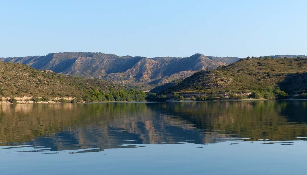
Caspe, on the shores of the Mequinenza reservoir (the “Sea of Aragon”) combines the tourist attractions of sport fishing and nautical activities with an important cultural heritage rooted in prehistory and history.
In the old town centre, the names of the streets and quarters tell of aljamas and juderías (the quarters of the Moors and Jews) and the friars of the Order of St. John. The most important monument is the group of the Colegiata de Santa María la Mayor del Pilar (14th century) and the remains of Bailio Castle, which had been recently restored. Inside the Colegiata there are two important relics: the Vera Cruz (True Cross) and the Cáliz del Compromiso (Holy Cups of Peace).
Every year, the historical event bearing its name is remembered: The Compromise of Caspe (1412), which ended the war between the kingdoms of Aragon and Valencia and the Principality of Catalonia. It is a popular medieval festival that takes place at the end of June.
We must also highlight the important archaeological heritage of the municipality. The most outstanding are the sites included in the Route of the Iberians – the Tallada and Loma de los Brunos – and the rock paintings of Plano del Pulido.
Caspe also has a wide range of museums, important civil architecture and a grandiose wreath of hermitages.
Position on the route
The Ebro River, Goya (The Painter) and The Memories of The Spanish Civil War Route
Don’t miss out!
Route of the Sea of Aragón - Caspe
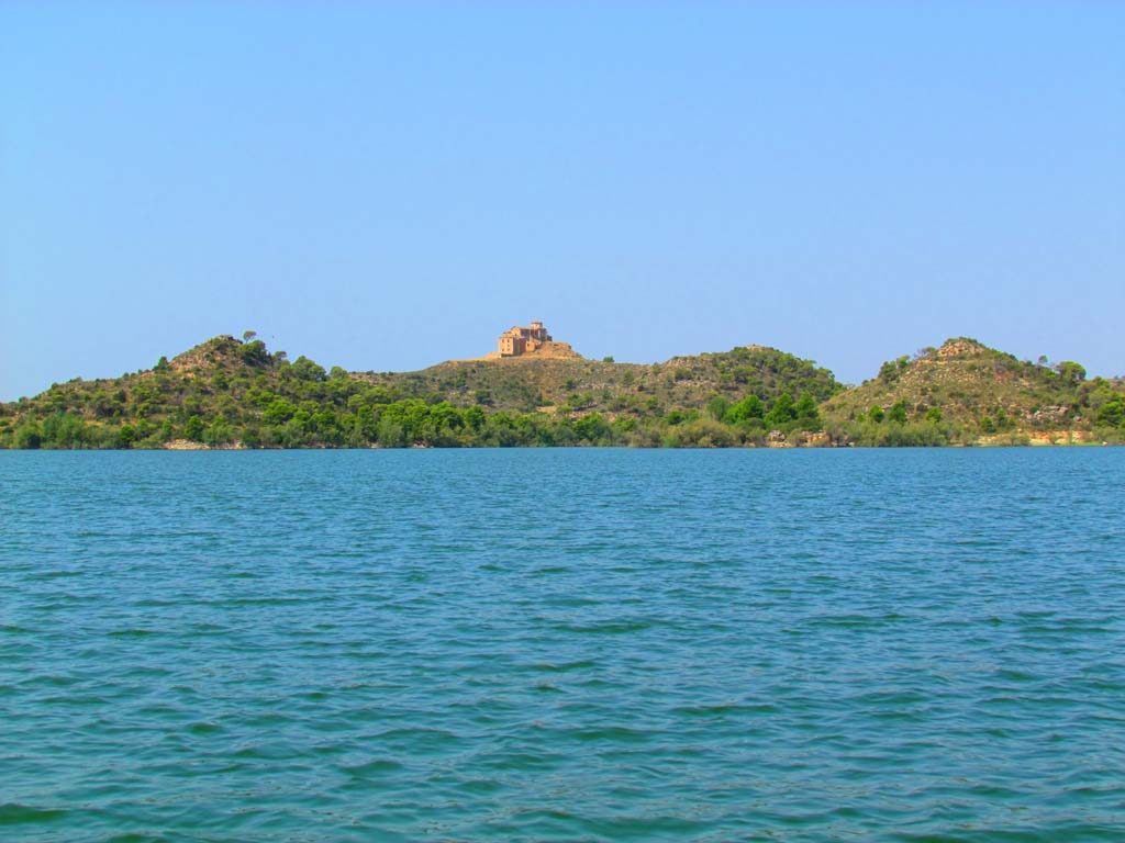
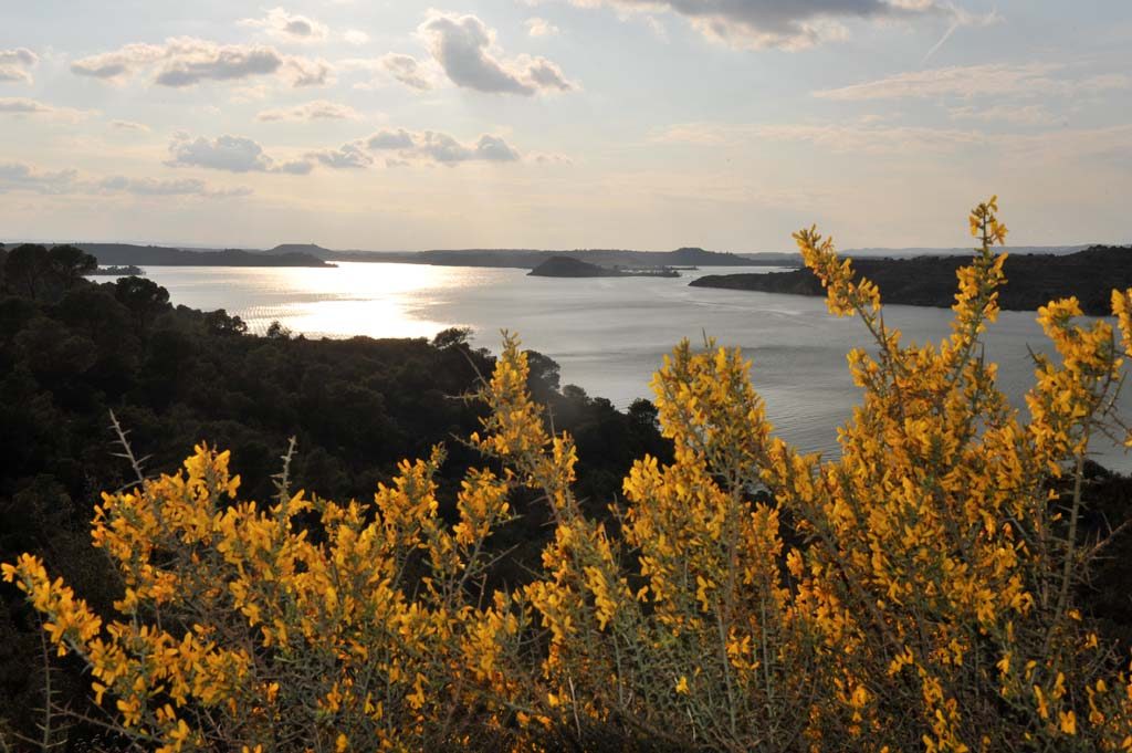
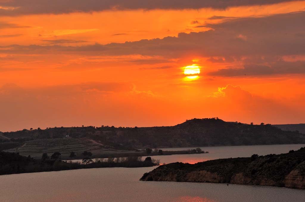
In Caspe, the "Route of the Sea of Aragón" is also known as the highway of Mequinenza; this highway has connected these two cities of the "Tierra Baja de Aragón" since ancient times.This road is also called "carretera de la costa" ("coastal road") because, from Caspe, it runs a long way parallel to the "Mar de Aragón" until it reaches Mequinenza and crosses the Ebro river over the bridge that leads us to the city of the miners.We leave Caspe on the old road that crosses the now dry course of the Guadalope River. Once you have crossed the Madrid-Barcelona railway line, take the N-211 road. Once you have crossed the first climb (Km 273 to 274), you will see the remains of the strategic Acropolis of San Juanista, which housed the Castle, the Convent and the Colegiata Santa María la Mayor. The place is worth a stop to take some photos. From here we can see the old town of Caspe as it lies on a slope above the Guadalope River.In the direction of Mequinenza, on the left, we start to see the "Sea of Aragón", a large reservoir of more than 100 metres in length in the old course of the Ebro river, from the Rueda monastery in Escatrón to the dam in Mequinenza, where the imposing hydroelectric power plant is to be found.At km 276,6 of the N-211 road, the traveller crosses the Greenwich Meridian and changes "from one part of the world to the other", from west to east. The view is very pretty, and a good opportunity to take a few pictures on one side and the other of the Greenwich meridian.The third obligatory stop is the new mouth of the Guadalope River, a few meters after the Greenwich Meridian (Km 277).The road runs up and down a long distance on an old Camino de Cabaña Real, an old path of transhumance or wandering pasture, which is now practically unused.The fourth stop is the Val de Pilas (Km 285,3). This large Val, as the small valleys between the hills (cabezos) are called in Aragón, begins in a small circle surrounded by mountains. Here there is a former railway station; the valley ends in an area called "La Herradura" (The horseshoe), where we discover the two Mediana and Chica islands.At sunset the photographs are unique. From a hill we see again the reservoir and the most emblematic island, La Magdalena, where we see a hermitage and a monastery that gives its name to the island. When the water level of the reservoir is high, it is a very photogenic angle, and we recommend a stop next to the reservoir (Km. 290). Behind Valcomuna the road climbs up to a plain called "Las Planetas", from where we have a wonderful view over the reservoir, the island, the Magdalena hermitage, the huge meander that forms the island, and the Sierra de Valdurrios mountains on the other side of the river. The view and the photographs are magnificent (Km. 291,5 – 292). At the end of the mountain and before we go down to the river, we can make the last photo stop (Km. 308,9). From the height of the last hill we can see the first part of the "Sea of Aragón", wedged between two mountains. As we descend towards the river, we see on the left the imposing dam of Mequinenza with its six weirs. At the foot of the dam we can see the hydroelectric power station, which is the main reason why the dam was built.We follow the river Ebro and cross it via a bridge over the tamed water of another reservoir, Ribarroja. Once the bridge is crossed, the traveller can admire the confluence of the Ebro and Segre rivers in the village of Mequinenza itself, which flow into a single reservoir; it is worth stopping and taking a few photos. Looking back at the castle, we see the ruins of the old village of Mequinenza on its southern slope.