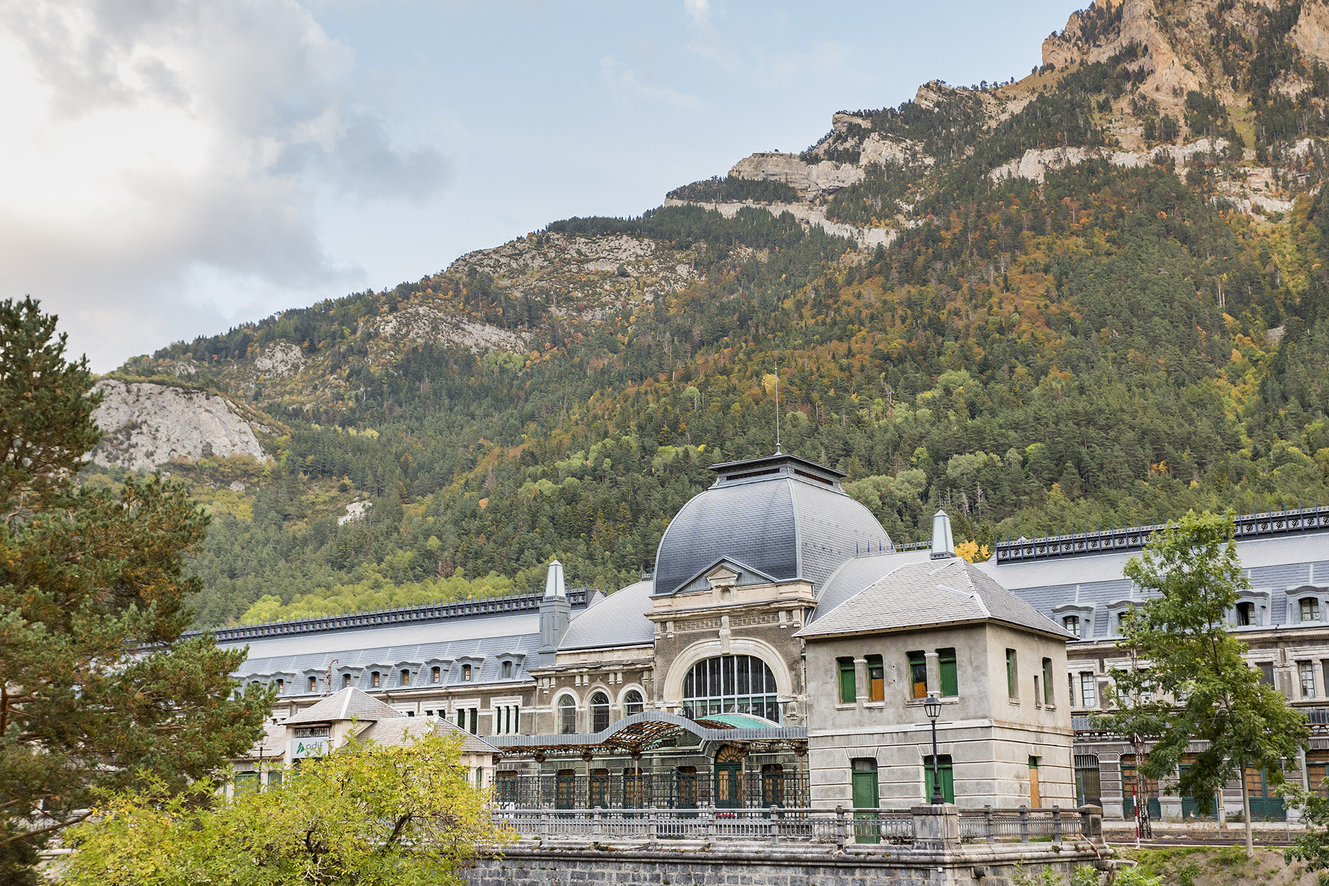
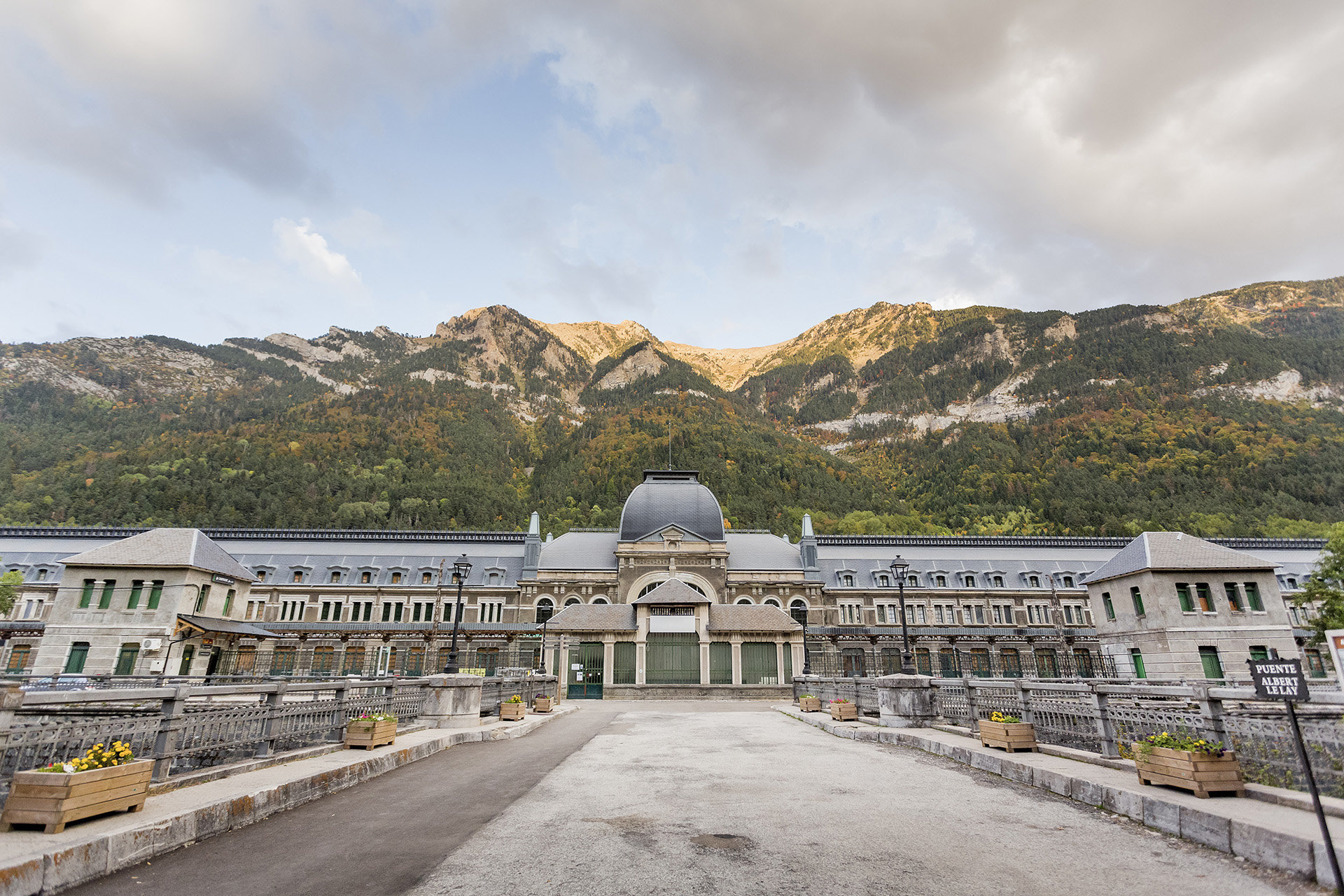
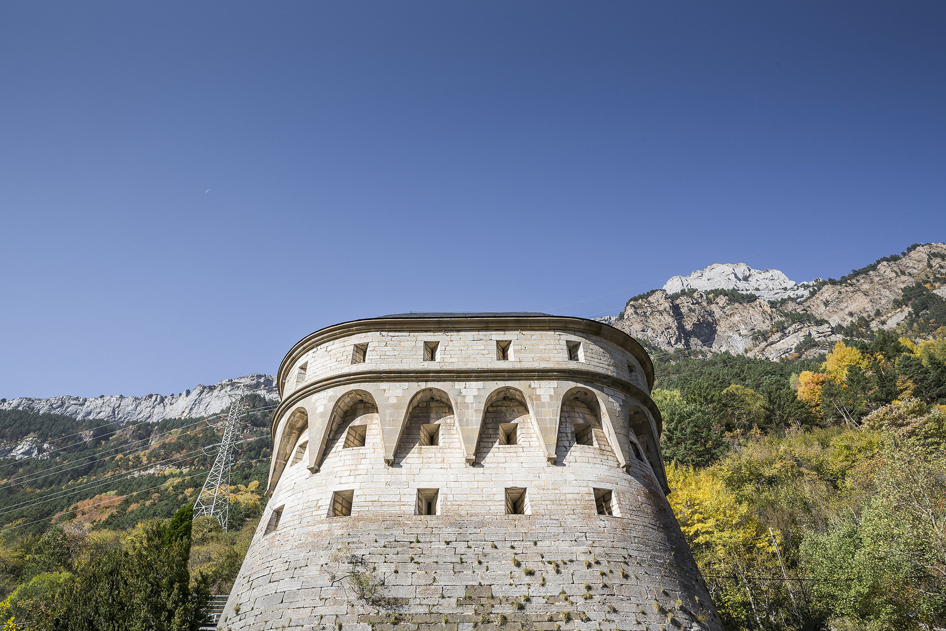
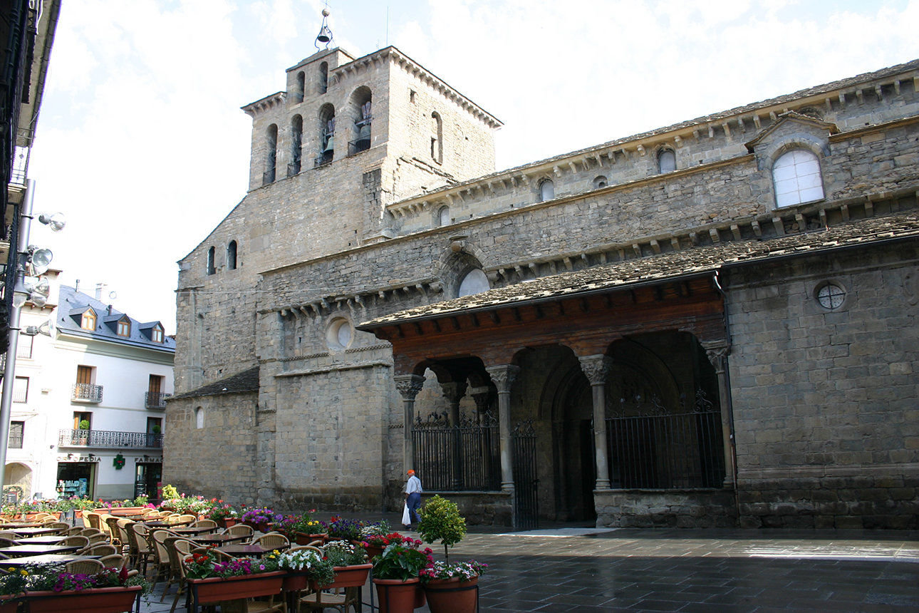
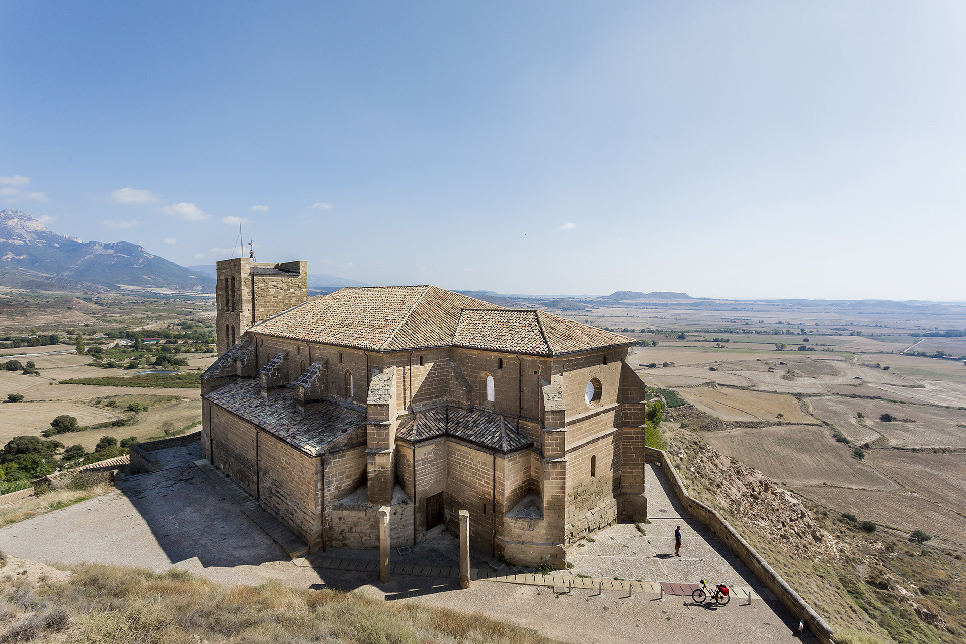
Aragon Kings Route

Aragón is a unique destination offering attractions difficult to ignore: An unrepeatable experience in a unique destination. You can discover this by taking the Aragon Kings Route, which crosses Aragon from north to south, evoking the historical advance of the formation of the territory of Aragon.

From the mythical Somport Pass, the historical entrance to the Kingdom, opened in 1035 in the Pyrenees valleys by its first king, Ramiro I, this exciting route extends through spectacular mountain landscapes, high Pyrenean peaks, valleys, crop fields, extensive countryside and vineyards, vibrant cities and some of the most beautiful villages in Spain.

The second king, Sancho Ramírez, founded the first city of Aragón, Jaca, where you will find incredible Romanesque architecture. The Kingdom expanded to the south, as you will discover on your trip: Pedro I incorporated Huesca; Alfonso I, the cities of Zaragoza and Daroca; and Alfonso II, the first King of the Crown of Aragon (son of Queen Petronilla and Prince Ramon Berenguer IV), who incorporated Teruel, the city of love, modernism and Mudejar.

In Aragon, the living history of Christians, Jews and Muslims, forms an air of hospitality and harmony. Escaping the routine and travelling through Aragon is to enter an endless world of sensations, as each location hides a different story where tradition, adventure and modernity are the stars.

Details of interest

  • Distance:
    440 km

    Estimated time without stops :7 h 24 min

    Recommended stages :5-6

Recommended stages

    1. Somport – Jaca
    2. Jaca – Ayerbe
    3. Ayerbe – Zaragoza
    4. Zaragoza – Daroca
    5. Daroca – Teruel – Sarrión
    1. Sarrión – Teruel – Daroca
    2. Daroza – Zaragoza
    3. Zaragoza – Ayerbe
    4. Ayerbe – Jaca
    5. Jaca – Somport

Map of route

Directions and points of interest

Congratulations, you are going to enjoy the slow driving route "Aragon Kings Route".
Follow the directions that we give you below and don't miss any of the details of these really marvellous places. Let's go!
DEPARTURE

The route starts at this location 102km from the capital, Huesca, on the road E7/N330a on the border between Spain and France, starting at the famous Somport Pass.

near_me DEPARTURE

The route starts at this location 102km from the capital, Huesca, on the road E7/N330a on the border between Spain and France, starting at the famous Somport Pass.

Puerto de Somport local_hotelrestaurant

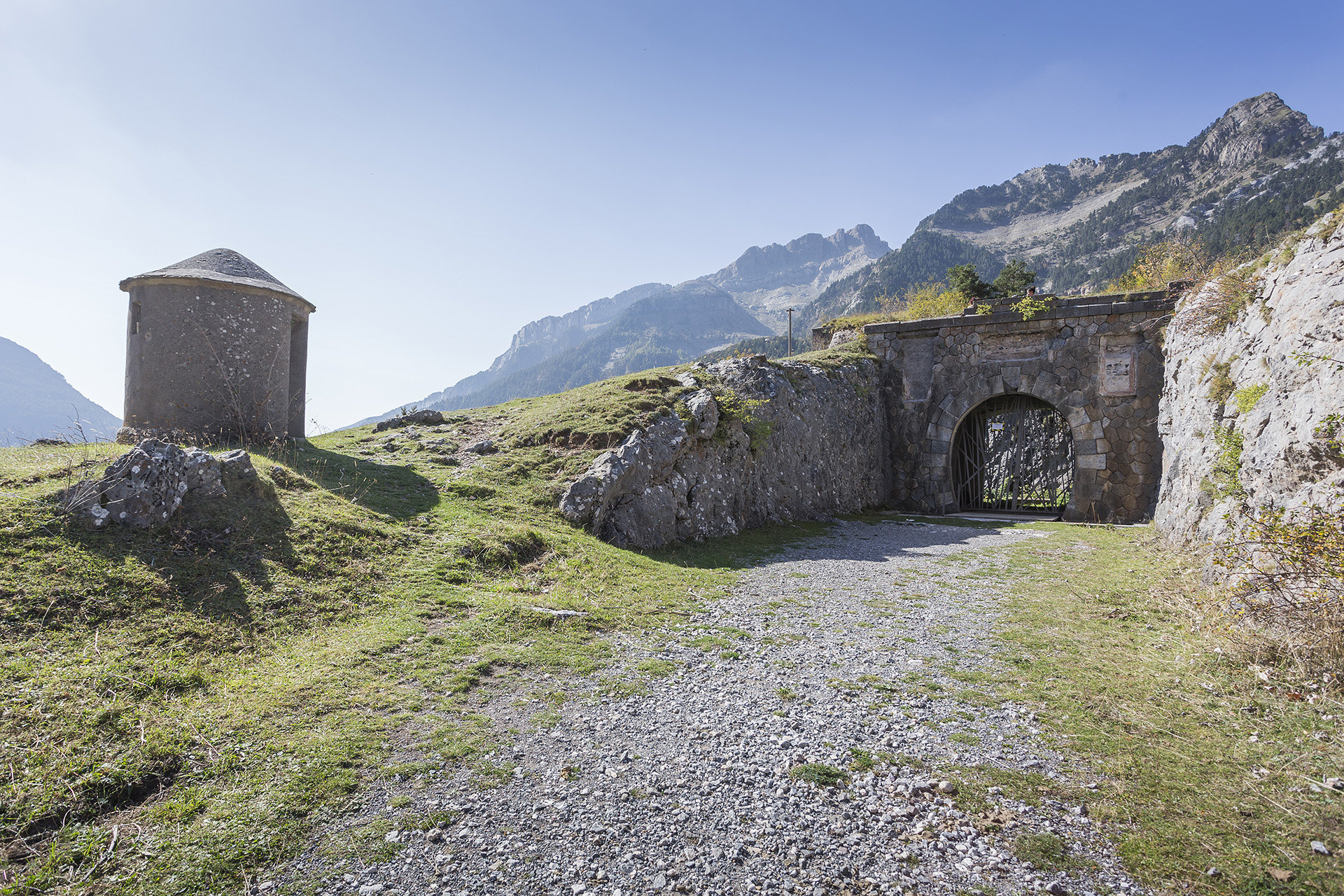
The historical Port of Somport, the “Summus Portus” of the Romans, is located at almost 1700 metres of altitude and has been, for centuries, the main passage of the central Pyrenees. Land protagonists of legends and historical episodes, the Somport is the starting point of the Aragonese section of the French Camino de Santiago and the “Great Route of the Kingdom of Aragon”.

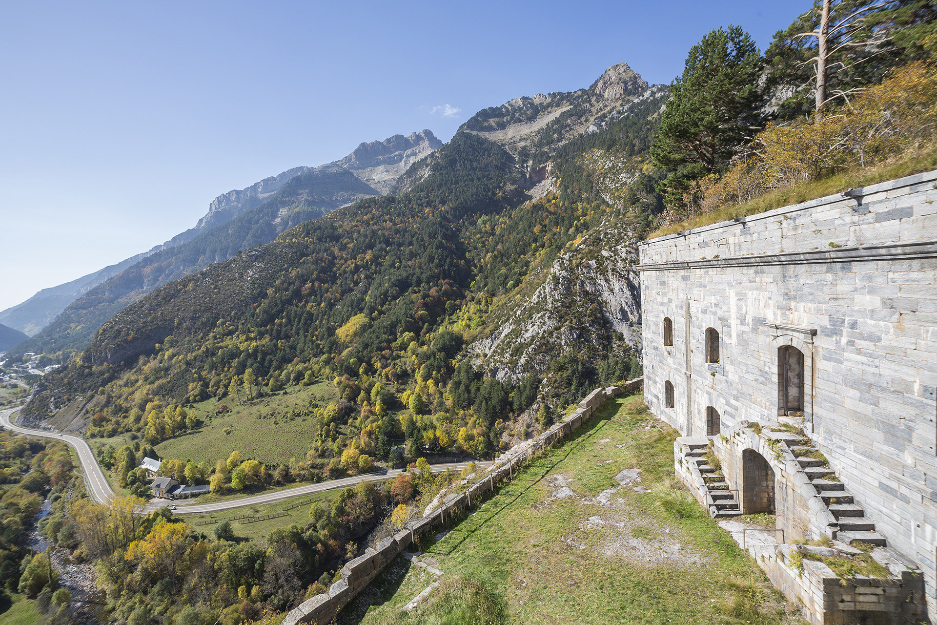
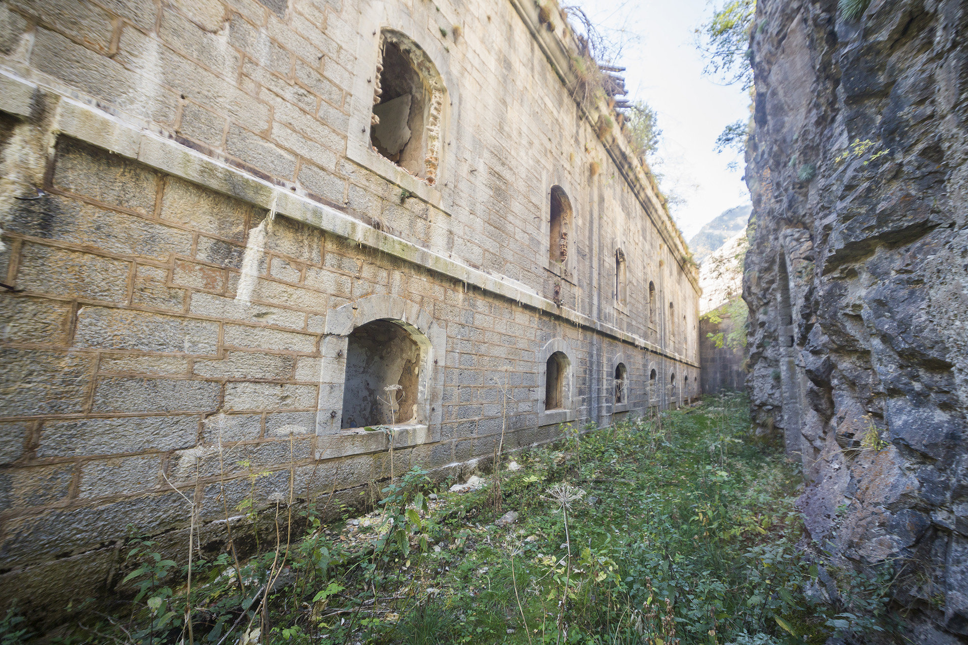
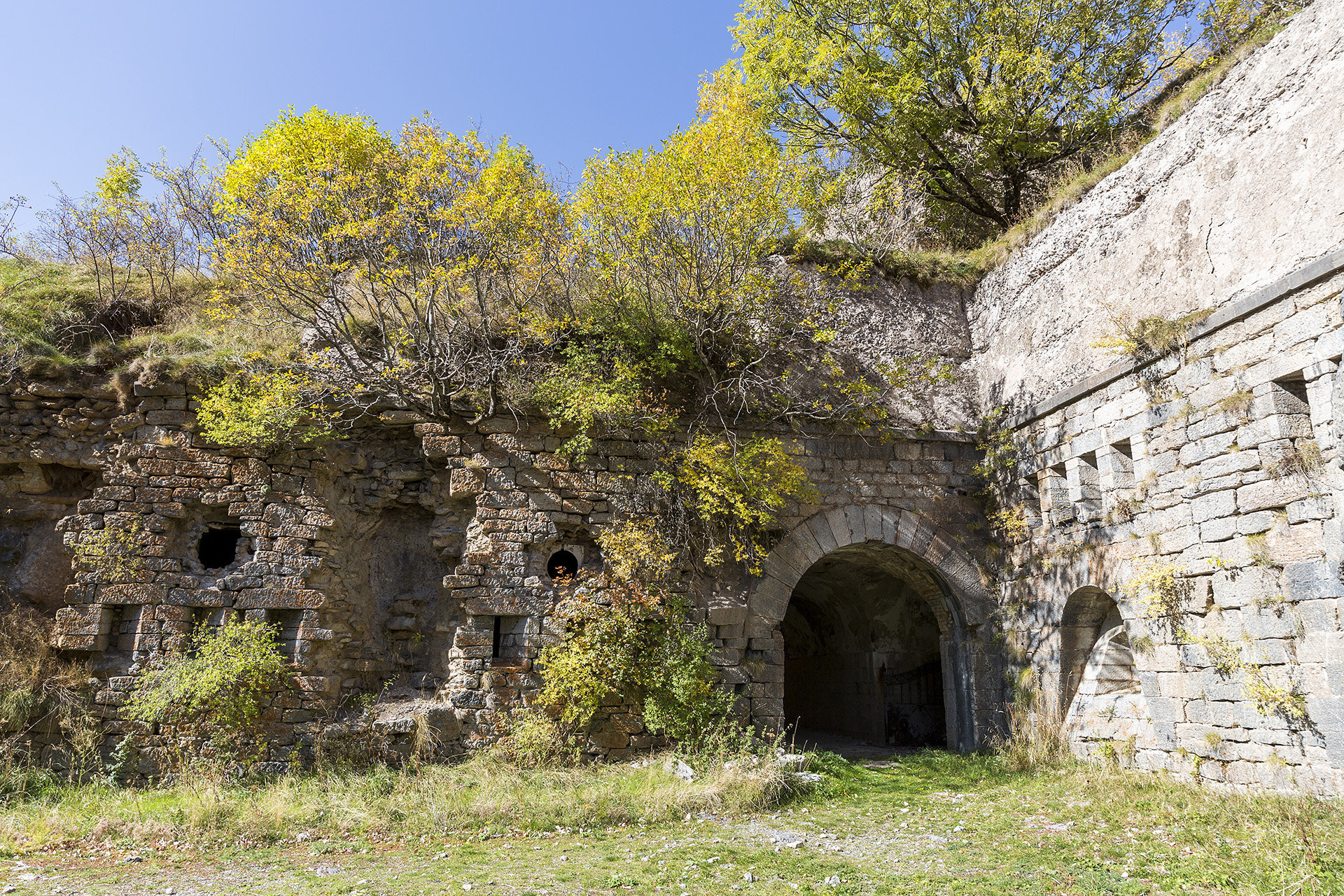
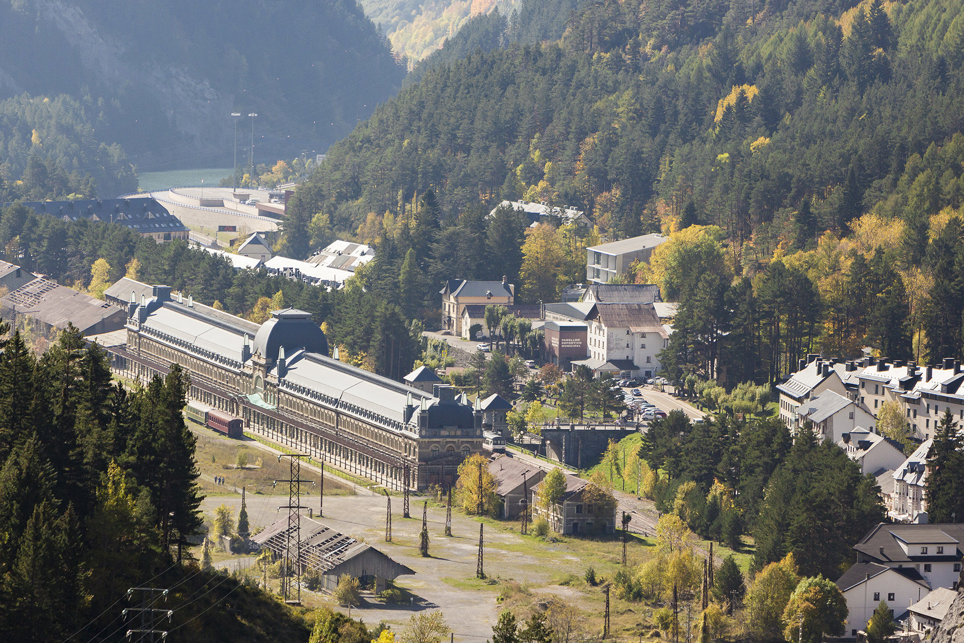
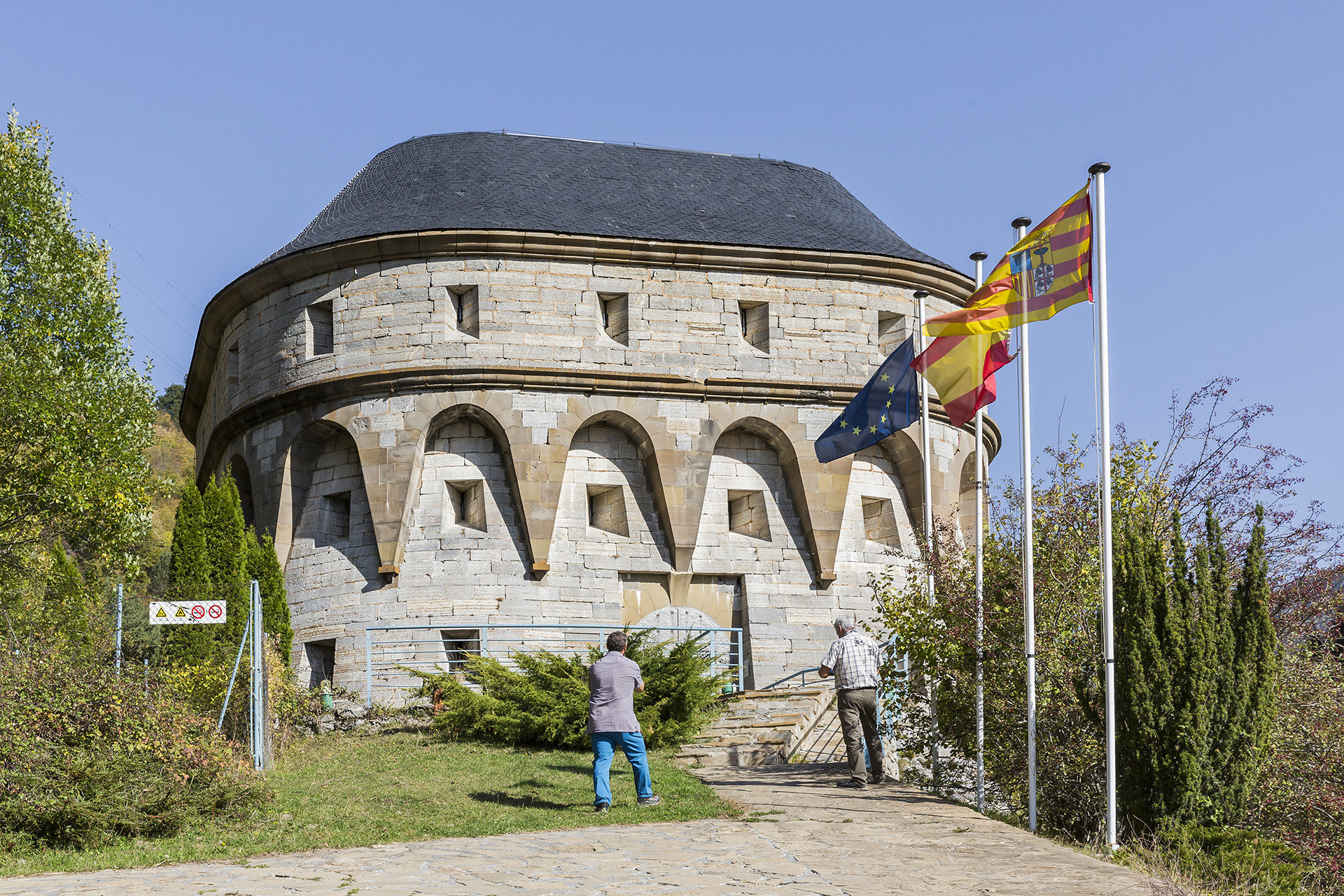
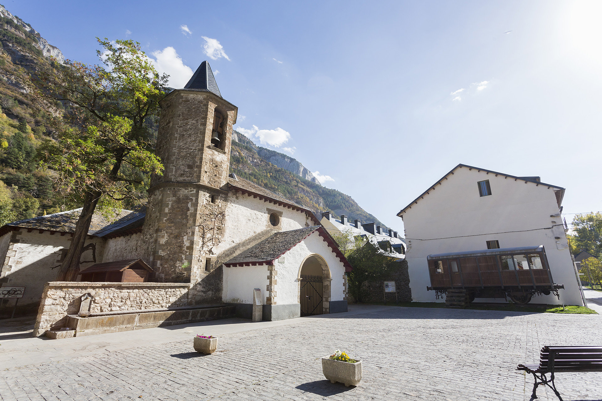
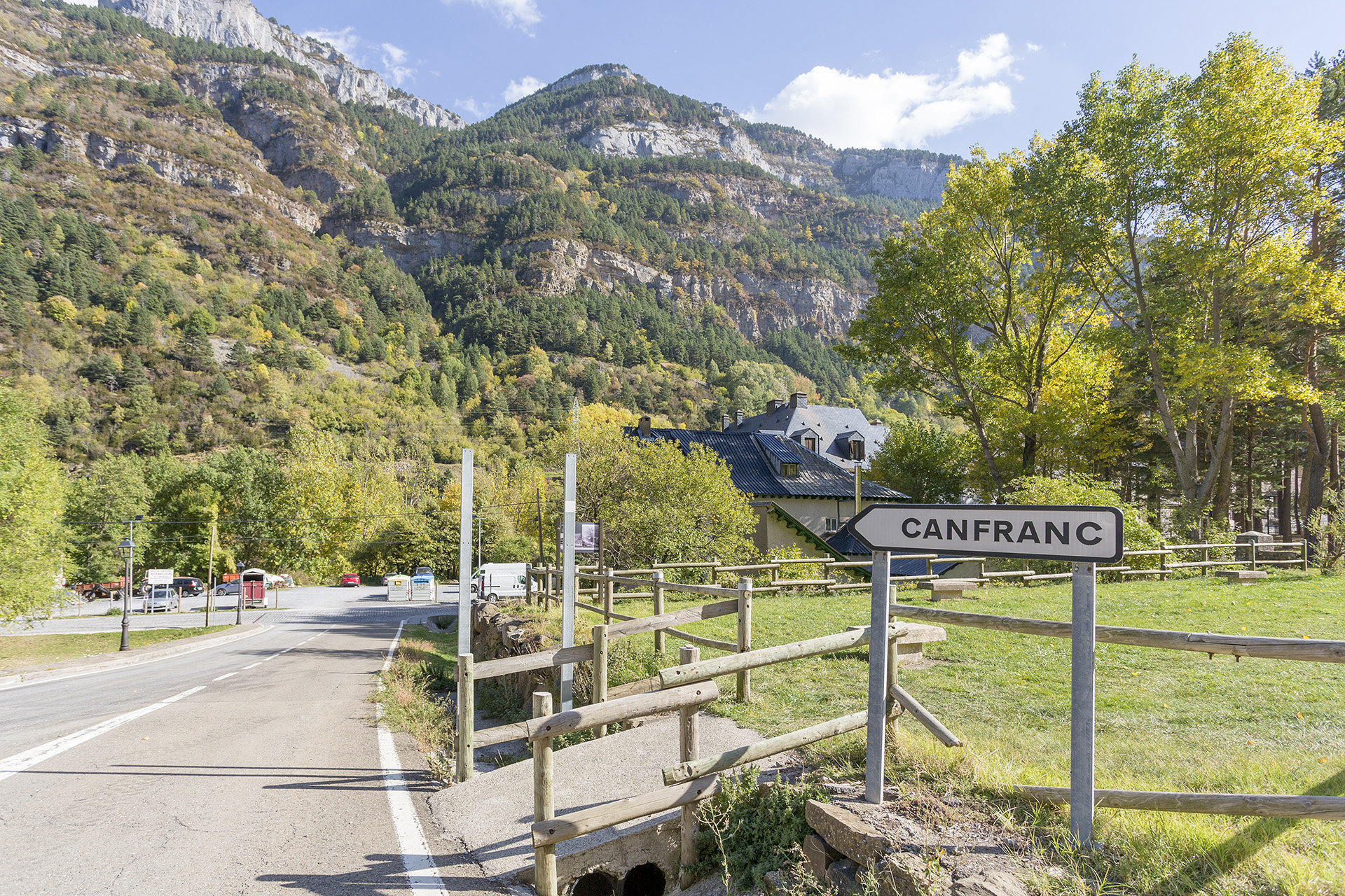
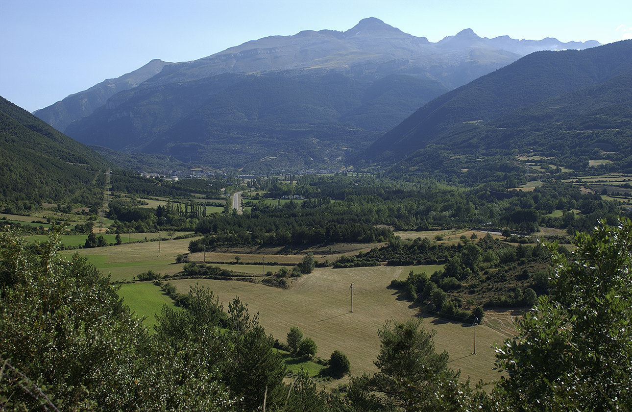
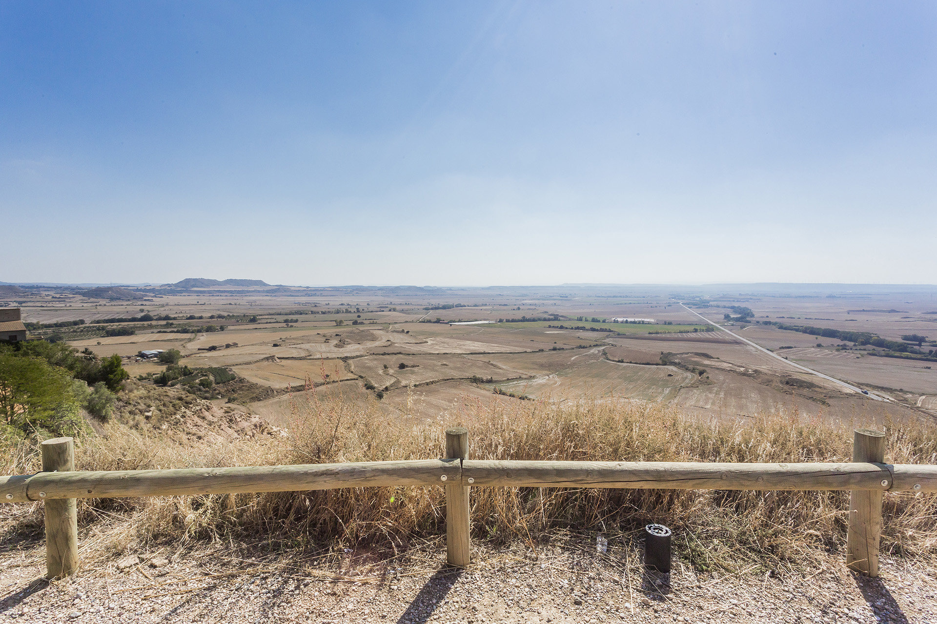
Here we will find spectacular landscapes of great summits of perpetual snow, masses of black pines, forests of beech and boxwood and ravines and narrow streams that lead to the River Aragon. At the foot of the port you can see the ruins of the old Hospital of Santa Cristina, where the pilgrims were welcomed, and which became the third largest in importance in the world after the Jerusalem Hospital and the Mont-Joux Hospital in the Alps.

Point 1

Leaving the Somport Pass going south on the E7/N330a towards Jaca, you will find the Coll de Ladrones fort after 6.9km. This section runs alongside both the left and right banks of the Aragón river.

near_me Point 1

Leaving the Somport Pass going south on the E7/N330a towards Jaca, you will find the Coll de Ladrones fort after 6.9km. This section runs alongside both the left and right banks of the Aragón river.

Coll de Ladrones

In the mid-19th century, the Spanish government was once again concerned about the defence of the Canfranc valley. For this reason, in 1888 the definitive project for the construction of the new fortress of “Coll de Ladrones” was approved, and the works were completed in November 1900.

It is a fortress of strong walls with a moat and drawbridge, which dominates the whole Canfranc valley, being the most strategic place in the whole area. Two buildings lined with local stone stand out. The shadiest with two naves and two floors was a troops barracks. The sunniest was reserved for officers, offices and an infirmary, with a stately staircase standing out in it. It is a fortress aimed at controlling smuggling and is the perfect example of modern military architecture adapted to the mountainous terrain; because here the rock is part of the defensive system, being just as important or more important than the factory walls. The fortress also conserves remains of its predecessor from the 18th century.

Point 2

Continuing south down the E7/N330a, again alongside the river, you come to Canfranc International Station after 1.6km.

near_me Point 2

Continuing south down the E7/N330a, again alongside the river, you come to Canfranc International Station after 1.6km.

Estación de Canfranc local_hotellocal_gas_stationrestaurant

The splendid International Station of Canfranc represents one of the most important works of Spanish modernism. Today, contemplating this magnificent building, you can still appreciate the traces of its ancient splendour. With a palatial air, the station was built between the end of the 19th century and the first quarter of the 20th century, being, at the time, the largest in Spain and the second largest in Europe.

Inside it housed a luxury hotel, casino, a customs agency, an office of the Bank of Spain, a canteen and infirmary. The huge station, 240 m in length, has 75 doors on each side and three levels. Eight years after its inauguration it was closed by the Civil War. In 1940 it was reopened and witnessed the passage of Swiss trains, in which the Germans transported the gold of the Jews to Madrid or Lisbon during World War II. The international line closed to traffic when in 1970 a small French freight train derailed. Communications were interrupted and have never again been resumed. Currently the station is declared a Historic-Artistic Monument and has guided tours, while it is in the process of recovery and advancing from Aquitaine and Aragon with different initiatives aimed at achieving its reopening as an International Station.

Point 3

After Canfranc Station, continue towards the Fusiliers Tower (Torre de los Fusileros), a historic building located a farther 1.9km south towards Jaca on the E7/N330a.

near_me Point 3

After Canfranc Station, continue towards the Fusiliers Tower (Torre de los Fusileros), a historic building located a farther 1.9km south towards Jaca on the E7/N330a.

Torre de los Fusileros

After crossing a tunnel at the exit of the Station of Canfranc, you can see the Tower of Felipe II, also known as the Tower of the Fusiliers, Espelunca Tower and, more popularly, as the Torreta (fortification supporting Coll de Ladrones).

This large stone and slate building is located at the beginning of a gorge that dominates the upper part of the valley. It was erected in 1879 to defend the border crossing, along with another that was next to the Somport tunnel. It is designed with taste, although without disregarding its military function that is manifested in the wall fixings, the pit and the solidity of its walls. It is a beautiful construction with an elliptical layout and a certain medieval air. Spread across four floors, the exterior presents three galleries with loopholes, the central one framed by a colourful gallery of arches and everything constructed in meticulous masonry.

Point 4

Another 2.3km south on the E7/N330a is the town of Canfranc.

near_me Point 4

Another 2.3km south on the E7/N330a is the town of Canfranc.

Villa de Canfranc local_hotelrestaurant

Just 2 km from the Station of Canfranc is the historic Canfranc, founded in medieval times as a border control station. Due to its exceptional location, sandwiched between the high mountains of the Pyrenees, it is a unique nucleus in front of the other towns of Jacetania.

The first of these characteristics is its town planning, where its sole street forms its structure. It conserves the typical trace of the towns of the Camino de Santiago organised longitudinally on both sides of the “pilgrimage towpath”. In this way, its only central street coincides with the Camino itself. Its inhabitants had the task of keeping the route clear of obstacles for travellers and pilgrims (which explains its name of “Campo Franco”). In 1617, Canfranc was destroyed by fire, leaving the church of La Asunción, two houses, the mill and the castle. After another devastating fire in 1944, there are now hardly any vestiges of its prosperous past. Today it is slowly recovering its population while new buildings are being built on the sites of the disappeared houses.

Point 5

Another 4.5km south on the E7/N330a is Villanúa. After Villanúa, heading towards Aratorés, you can enjoy the Origins of the Kingdom route; or you can continue along the Aragon Kings route.

near_me Point 5

Another 4.5km south on the E7/N330a is Villanúa. After Villanúa, heading towards Aratorés, you can enjoy the Origins of the Kingdom route; or you can continue along the Aragon Kings route.

Villanúa local_hotellocal_gas_stationrestaurant

Villanúa preserves, before entering the town, a section of the old Roman road that reaches the medieval bridge that leads to the urban centre and that coincides with the French Camino de Santiago. In this beautiful Pyrenean village, it is interesting to visit its old quarter, formed by a network of small streets that preserve the tradition of another era: the fountain of the four pipes, the old town hall (with its doorway and Gothic windows), a large number of houses and fortified palaces with their shields of infanzones, the alleys or the houses turned into houses that allow us to discover part of the medieval story of the town.

The church of San Esteban is a building from the 11th century with various modifications. The feature that stands out is a magnificent Romanesque carving of the Virgin and Child from the late 10th or early 11th century known as Nuestra Señora de los Ángeles. This carving is catalogued by the experts in Romanesque art as one of the best pieces of that period for the polychromy and the expressiveness of the figure. Do not miss out on a magical visit to the Cueva de las Güixas while in this town.

Point 6

Another 13.6km south on the E7/N330a is Jaca centre. Just before arriving, you can see the Rapitán Fort on the left.

near_me Point 6

Another 13.6km south on the E7/N330a is Jaca centre. Just before arriving, you can see the Rapitán Fort on the left.

Jaca local_hotellocal_gas_stationrestaurant

Jaca is the capital of the Aragonese Pyrenees. Its history was the first city of Aragon, its location and its demographic importance make it an important service centre and a first-rate tourist capital. Its cathedral is one of the most important monuments of the peninsular Romanesque, as much for its antiquity as for the stylistic changes that were exported from there to the rest of the Spanish Romanesque. Its diocesan museum is one of the best in the world in terms of medieval painting.

La Ciudadela, a magnificent pentagonal military fortification, is the most emblematic building in Jaca. The main road of the city is the Calle Mayor, a road that brings together some of the main buildings, such as the beautiful town hall. In the rest of the street many houses of the bourgeoisie of the early 20th century were constructed. Other significant buildings such as the Monastery of Las Benedictines, the Fortress of Rapitán or the Clock Tower, demonstrate the confluence of styles in the town. But Jaca is much more. Strolling through its streets brimming with commercial life, rewarding yourself with the exquisite pastries from Jaca or tasting its gastronomic delights in its many bars and restaurants is a real delight.

Point 7

South of Jaca is the Peña Oroel mountain. At the bottom of Avenida Regimiento de Galicia is a roundabout, where you take the second exit (A1205) towards Bernués and San Juan de la Peña for 10.1km until the turn-off to the legendary road leading to the Parador de Oroel.

near_me Point 7

South of Jaca is the Peña Oroel mountain. At the bottom of Avenida Regimiento de Galicia is a roundabout, where you take the second exit (A1205) towards Bernués and San Juan de la Peña for 10.1km until the turn-off to the legendary road leading to the Parador de Oroel.

Puerto y parador de Oroel restaurant

Mount Oroel, 1,770 metres high, is one of the hallmarks of Jaca and is visible from anywhere in the city. Access from Jaca, only 9 kilometres away, is via the A-1205 road. Before reaching Bernués there is a detour to the left towards the Parador de Oroel. A narrow and beautiful road takes us through a lush forest to the Parador. It is a beautiful stone building located in a meadow with a bar-restaurant that has a great viewpoint towards Jaca and a good part of the Aragonese Pyrenees. From there, the climb to the Cross of Oroel begins. It is an easy route, although it has some steep sections. The trail is perfectly signposted.

Point 8

Go back from where you came and re-join the A1205 southwards to get to Bernués. This section is 13km from the Parador de Oroel.

near_me Point 8

Go back from where you came and re-join the A1205 southwards to get to Bernués. This section is 13km from the Parador de Oroel.

Bernués

Bernués is located on a hill on the old royal road from Zaragoza to Jaca, to the south of Peña Oroel and the Sierra de San Juan de la Peña.

It is a typical example of a town-street, the urban area preserves remarkable samples of popular domestic architecture like Casa Bisús, casa infanzona from the 17th century, or Casa Gairín from the 18th century. The parish church of San Martín de Tours is a baroque building with a rectangular layout, its walls lined internally with polychromatic stuccos that mask the humbleness of its building. The altarpieces of its chapels and especially the main altarpiece dedicated to La Asunción contribute to this. Over the entrance door there are the remains of a Romanesque Christ of unknown provenance.

Point 9

Leaving Bernués and again re-joining the Jaca-Santa María de la Peña road (A1205), it is 13.5km to Anzanigo. This stretch has the Barranco de Bernués on the left and, upon reaching Anzanigo, you cross the Gállego river. A short distance from Anzánigo, you can turn off towards Rasal and continue with the Secrets of the Pre-Pyrenees route on the left or continue with the main Aragon Kings route.

near_me Point 9

Leaving Bernués and again re-joining the Jaca-Santa María de la Peña road (A1205), it is 13.5km to Anzanigo. This stretch has the Barranco de Bernués on the left and, upon reaching Anzanigo, you cross the Gállego river. A short distance from Anzánigo, you can turn off towards Rasal and continue with the Secrets of the Pre-Pyrenees route on the left or continue with the main Aragon Kings route.

Anzánigo

Located at 594 metres of altitude, to the south of the Protected Landscape of San Juan de la Peña and Monte Oroel, Anzánigo is the most western town of the region of Alto Gállego. The most outstanding buildings are the medieval bridge and the church.

The bridge is 102 metres long and has 5 semi-circular spans. The church of Santa Águeda is a 17th century construction of a single nave covered by a vault of lunettes. The main altar is presided by a baroque altarpiece next to the carving of the Virgin of Izarbe, deriving from a Romanesque chapel located on the outskirts of the town. With the construction of the tunnels of Monrepós and the adaptation of the Port of Santa Bárbara, Anzánigo was losing its population. Nowadays it is a magnificent place for those who want to escape from the best known tourist destinations and to do some hiking, biking, rafting, visit ravines, go fishing …

Point 10

Continue along the A1205 for 9.1km towards Triste, bordering the winding Gállego river once again on the left.

near_me Point 10

Continue along the A1205 for 9.1km towards Triste, bordering the winding Gállego river once again on the left.

Triste

Belonging to the municipality of Las Peñas de Riglos, Triste is located at the northern end of the La Peña reservoir, on the right bank of the River Gállego. Highly recommended for lovers of Romanesque is its parish of Santa Maria from the 12th century, which has a beautiful and slender bell tower next to the Lombard apse. With that in mind, the wooden textile workshop, dedicated to artisan weaving, represents a visit of great ethnographic interest.

Point 11

The Peña Reservoir is next to Triste, towards the South. This new section largely borders the reservoir. Take the A1205 to get there, passing through La Peña and Santa María before crossing an old iron bridge over the Gállego river. Here, you join the A132 south and are parallel to the railway track, which also stretches across the river. The total distance to the La Peña Dam is 5.4km.

near_me Point 11

The Peña Reservoir is next to Triste, towards the South. This new section largely borders the reservoir. Take the A1205 to get there, passing through La Peña and Santa María before crossing an old iron bridge over the Gállego river. Here, you join the A132 south and are parallel to the railway track, which also stretches across the river. The total distance to the La Peña Dam is 5.4km.

La Peña Reservoir restaurant

Located between the towns of Santa María de la Peña and La Peña, the La Peña reservoir is one of the oldest dams in Spain. The reservoir owes its name to the rock on which the dam is constructed. Through this dam, and through different galleries excavated in the rock, the riverbed is discharged into the River Gállego. The reservoir was built between 1904 and 1913 with the function of regulating this river just before entering the gorge that runs next to the Mallos de Riglos. Grabbing our attention is the bridge that saves the reservoir built by Severino Bello, in keeping with the railway architecture of the time. A few kilometres along on another bridge, in La Peña Station, the railway allows the legendary ‘Canfranero’ to save the river to or from Riglos.

Point 12

Crossing the La Peña Dam, take the A132 to the left southwards, again skirting the Gállego river. This section to Murillo de Gállego is 9.9km, where you can see the spectacular Mallos de Riglos.

near_me Point 12

Crossing the La Peña Dam, take the A132 to the left southwards, again skirting the Gállego river. This section to Murillo de Gállego is 9.9km, where you can see the spectacular Mallos de Riglos.

Murillo de Gállego local_hotelrestaurant

The town of Murillo de Gállego is framed in a spectacular setting with the imposing Mallos de Riglos in the background, Peña Rueba behind, and the wild River Gállego at its feet.

Murillo presents a charming urban centre formed by an irregular network of streets that have adapted perfectly to the morphology of the land. Housing is mainly stone and rammed earth that are in keeping with the typical architecture of the area. The monumental church of El Salvador stands majestically above the town. Declared a National Monument, it is one of the icons of Aragonese Romanesque art that dominated the area in the 11th and 12th centuries. Inside, the crypt of Santo Cristo is a highlight, consisting of three naves. The importance of this crypt is that it is one of the eight that exist of this type in the Peninsula. Murillo offers a different tourism alternative and one that is in harmony with nature: adventure sports, excursions, hidden corners where you can unwind…

Point 13

Continue southeast along the A132 for 10.1km to Ayerbe, crossing the Gállego Bridge along the way. After Ayerbe, you can continue along the main Aragon Kings route towards Bolea Loarre Castle on the A1206, the Aragon Kings route towards Puendeluna on the A125 or take the Castles route towards Santa Eulalia de Gállego on the A1202.

near_me Point 13

Continue southeast along the A132 for 10.1km to Ayerbe, crossing the Gállego Bridge along the way. After Ayerbe, you can continue along the main Aragon Kings route towards Bolea Loarre Castle on the A1206, the Aragon Kings route towards Puendeluna on the A125 or take the Castles route towards Santa Eulalia de Gállego on the A1202.

Ayerbe local_hotellocal_gas_stationrestaurant

The village of Ayerbe is located in the impressive natural and cultural surroundings of the Kingdom of Los Mallos. A historical and monumental town perched on the left bank of the River Gállego at the foot of the Loarre and Luna mountains. Walking through its streets you can see magnificent manor houses and mansions. The tower of San Pedro dating back to the 12th century stands out from its town centre. The two squares of the town are designed around the palace of the Marquises of Ayerbe, in a Gothic-Renaissance style.

The church of San Pedro has an interesting religious museum and an organ from the mid-19th century. Here is where the greatest Spanish scientist and Nobel Prize winner for medicine, Santiago Ramón y Cajal, spent his youth.

In Ayerbe we find history, art and richness of landscapes, but also customs, cultural activities, gastronomy, (you cannot miss out on the famous tortas de Ayerbe) and the special flora and fauna of the Kingdom of Los Mallos. The area is also ideal for adventure sports.

Point 14

To get to Bolea and see its collegiate church, leave Ayerbe by the A132, going 13.8km to Esquedas. At that point, turn left onto the A1206 and travel 5.3km until you reach Bolea.

near_me Point 14

To get to Bolea and see its collegiate church, leave Ayerbe by the A132, going 13.8km to Esquedas. At that point, turn left onto the A1206 and travel 5.3km until you reach Bolea.

Collegiate Church of Bolea local_hotelrestaurant

Just 12 km from the Castle of Loarre, Bolea is situated on a promontory dominating the plains of La Hoya de Huesca/Plana de Uesca. Strolling through the town there are numerous buildings of interest with several manor houses with noble coats of arms.

At its highest point, the Collegiate Church of Santa María looks like a masterpiece of the Aragonese Renaissance. The building from the 16th century was built on an old Romanesque temple, of which the crypt and the bell tower are still preserved. But the most valuable jewel of this temple is the main altarpiece, a “masterpiece of the Spanish painting of the Renaissance”. It is composed of a splendid combination of 20 panels painted in tempera and 57 polychrome wood carvings. But the truly exceptional aspect of this altarpiece is the wonderful paintings made by the “maestro de Bolea”, an anonymous painter who uses stylistic features typical of the Flemish and Italian movements in which expressivity, the dominance of space and perspective, light and shading are key features.

Point 15

Exit Bolea from the Collegiate church via Calle Medio and Calle Carretera to the roundabout where you entered the town. This time, turn right to take the A1206 north towards Loarre. After reaching the village, follow the signposted road to the castle about 3km away. The total distance is 12.3km.

near_me Point 15

Exit Bolea from the Collegiate church via Calle Medio and Calle Carretera to the roundabout where you entered the town. This time, turn right to take the A1206 north towards Loarre. After reaching the village, follow the signposted road to the castle about 3km away. The total distance is 12.3km.

Castle of Loarre local_hotelrestaurant

This emblematic fortress, built between the 11th and 12th centuries, is located very close to Ayerbe. Loarre is the grandest and most spectacular castle in Aragon and is considered the best preserved Romanesque castle in Europe. The fortress defended the border line of the kingdom of Aragon to later become a royal palace and then a monastery.

From an architectural point of view, it is one of the most perfect examples of Romanesque art in Spain and Europe. It occupies a spectacular settlement on a high cliff and is surrounded on its south side by a 13th century wall, the rest being protected by the same rock on which the fortress sits. A walk through its interior, more than one thousand metres high, is a true journey back in time to the Middle Ages. A tour of its passageways, towers and dungeons will make us dream of legends of medieval knights, queens looking out from their lookout towers and times of a harsh and austere life in an impressive setting. From the Mirador de la Reina viewpoint there is a fantastic view of the Hoya de Huesca.

Point 16

Leave Loarre by Calle Carlos Garulo Ena in the south and turn right to take the A1206 south to Ayerbe. Carry straight on through Ayerbe where the road becomes the A125 towards Ejea. You will pass by Biscarrues and Ardisa, where you cross the river Gállego again. Continue to the CV811 on the left, which is the road for Puendeluna. This section is 24.1km long.

near_me Point 16

Leave Loarre by Calle Carlos Garulo Ena in the south and turn right to take the A1206 south to Ayerbe. Carry straight on through Ayerbe where the road becomes the A125 towards Ejea. You will pass by Biscarrues and Ardisa, where you cross the river Gállego again. Continue to the CV811 on the left, which is the road for Puendeluna. This section is 24.1km long.

Puendeluna

Located on the right bank of the River Gállego, Puendeluna owes its name to a bridge already existing in Roman times built to save the waters of this river. Among the most important heritage of the municipality is the parish church of San Nicolás, which was completely rebuilt at the beginning of the 20th century. Inside you can see two treasures, such as the Gothic altarpieces of San Nicolás de Bari and San Bartolomé from the second half of the 15th century and the flamenco Spanish style.

Near Puendeluna, in the municipality of Ardisa, is the castle of La Ballesta. This castle has the peculiarity of being, along with that of Obano, the only one of the Romanesque period in Aragon that is built on level ground and not on an elevated level. The building has a late Gothic style, although the slim tower that emerges from the centre of the palace dates from the end of the 11th century. The enclosure is square, like its tower. Numerous loopholes are observed, both in its walls and in the tower. It retains a crenellated roof, and remains of the lowered wall that surrounds it.

Point 17

Return by the road you entered from Puendeluna and continue south, passing Piedratajada and Marracos. After a row of cypresses, you reach a junction at Gurrea de Gállego, where you turn right along the A1209. After 1km, take the turning on the left towards La Paúl, cross the village, turn right at the end of the village and continue until the road for the Hermitage at Nuestra Señora del Salz. This stretch is 26.9km in total.

near_me Point 17

Return by the road you entered from Puendeluna and continue south, passing Piedratajada and Marracos. After a row of cypresses, you reach a junction at Gurrea de Gállego, where you turn right along the A1209. After 1km, take the turning on the left towards La Paúl, cross the village, turn right at the end of the village and continue until the road for the Hermitage at Nuestra Señora del Salz. This stretch is 26.9km in total.

Nuestra Señora del Salz

The Santuario de Nuestra Señora del Salz is located in the highest area of ​​a gypsum cliff and about forty metres above the road that joins the town of Zuera with the town of La Paúl. According to the tradition in this place the Virgin appeared to a Knight Templar.

From this privileged location there is a magnificent panorama ready to be discovered: the plains of Somontano and the sierras that are ascend to the Pyrenees, the wide fertile plain of the Gállego, the extensive fields of the Monegros or the towers of Zaragoza and the orchards of the Ebro. In the place where today a chapel stands, the Muslim castle of Salcey was erected. The Santuario has had many changes and transformations over the centuries. The current chapel, which is accessed by a long staircase, is a building with a single nave of five sections covered with a barrel vault. Inside, the central part of the altarpiece is occupied by the image of the Virgen del Salz, a Romanesque carving in polychrome wood.

Point 18

Leave the Hermitage and continue south to join the A124 to Zuera. Go through the town and the road becomes the N330a. Continue on the N330a and pass through Villanueva de Gállego and follow the road to Zaragoza. In the city centre, you will find the main jewels of the Aragonese capital. From here you can continue with the Aragon Kings route or go to Borja 65km away and start the Heart of Moncayo route. The total distance is 38.7km.

near_me Point 18

Leave the Hermitage and continue south to join the A124 to Zuera. Go through the town and the road becomes the N330a. Continue on the N330a and pass through Villanueva de Gállego and follow the road to Zaragoza. In the city centre, you will find the main jewels of the Aragonese capital. From here you can continue with the Aragon Kings route or go to Borja 65km away and start the Heart of Moncayo route. The total distance is 38.7km.

Zaragoza local_hotellocal_gas_stationrestaurant

With more than two thousand years of history, Zaragoza is configured as a great melting pot of cultures. Next to the sturdy walls, the statue of Emperor Augustus contemplates the city that he founded. Near the Plaza de las Catedrales you can find the Foro Museum and the museum of what was the Roman River Port. In the old town you can visit the Museum of Public Baths and the Theatre, one of the buildings for larger representations of Hispania.

But if Zaragoza flourished in Roman times, the same happened during its Islamic period. This can be seen walking through the courtyards of the palace of La Aljafería, one of the pinnacles of Hispano-Muslim art. In the silhouette of the city there is also a set of Mudejar towers declared to be World Heritage by UNESCO. The prosperity of the city in the Renaissance, known at that time as the Florence of the Iberian Peninsula, is evident in the beautiful buildings scattered throughout the historic city centre, such as La Lonja, a unique example of a building of this kind in an inland city, which gives us an idea of ​​its commercial importance. And on the banks of the River Ebro is the Basilica del Pilar, the largest baroque temple in Spain and an icon of Zaragoza par excellence. A few metres away, the splendid Cathedral of San Salvador, is an eclectic set of artistic styles, a political and religious centre of the Crown of Aragon, where they swore Los Fueros, where their kings were crowned. Also impressive are its modernist and historicist traces. Zaragoza is a modern, dynamic city full of economic and social activity. An accredited city of congresses, renewed and embellished after the 2008 International Expo.  Undoubtedly, the city of Zaragoza is a first-rate tourist destination, for its monuments, its museums (Museum of Zaragoza, Pablo Gargallo, Origami, Goya-Ibercaja, Pablo Serrano, Alma Mater Museum,…), its parks, its natural spaces, its cultural offer, its gastronomy and, in short, its potential as an average European city that requires a prolonged visit.

Point 19

To leave the centre of Zaragoza and head south towards Teruel, go from Plaza Aragón, Gran Vía, Fernando el Católico, Isabel la Católica, Vía Ibérica and take the N330. Continue down this road and turn off at the second exit of the roundabout for Santa Fe, which has a monastery of the same name. The distance is 11.5km.

near_me Point 19

To leave the centre of Zaragoza and head south towards Teruel, go from Plaza Aragón, Gran Vía, Fernando el Católico, Isabel la Católica, Vía Ibérica and take the N330. Continue down this road and turn off at the second exit of the roundabout for Santa Fe, which has a monastery of the same name. The distance is 11.5km.

Monasterio de Santa Fe restaurant

To the south of Zaragoza, between the towns of Cuarte de Huerva and Cadrete, is the Monastery of Santa Fe. It was built in 1341 following the transfer of the monks of the Monastery of Fonclara, founded by Jaime I in 1223. Later it was rebuilt in the 18th century, marking its baroque style. In 1808 the Napoleonic wars had serious consequences for the monastery during the first Siege of Zaragoza. The definitive order to leave came to the clergy in 1835 with the disentailment of Mendizábal. From then on, the lands and properties of the monastery changed hands, neglecting their conservation. The temple has a basilica layout of three naves that were covered with vaults that have collapsed. The cross is covered with a large dome on an octagonal tambour. The tower that is attached to the base has three bodies of brick that are topped with a dome on tambour.

Point 20

Leave Santa Fe, return to the N330 towards Teruel and continue the 18.9km to Muel

near_me Point 20

Leave Santa Fe, return to the N330 towards Teruel and continue the 18.9km to Muel

Muel local_hotellocal_gas_stationrestaurant

Located 40 kilometres south of Zaragoza, Muel is known for its ceramic school and workshop, where authentic works of art are elaborated, continuing with the pottery tradition of the village that dates back to the 11th century. This school and workshop also has an exhibition hall, in which works by different artists are exhibited throughout the year.

However, Muel is also a town that is worth strolling through to enjoy the heritage that the various cultures have left behind in it. Its old town, with narrow and winding streets, is a good example of its Arab past. There are several Renaissance style palace-houses and the parish church of San Cristóbal, belonging to the Late Baroque and enriched with Mudejar elements. In the chapel of La Virgen de la Fuente, built on a Roman dam, you can see the pendentives of the dome painted by a young Goya. In them, the great painter, magnificently represented the four Fathers of the Church. At the foot of the chapel there is a beautiful municipal park with a pond.

Point 21

Leave Muel, which is famous for its pottery, by Avenida García Giménez and re-join the N330 until you reach Longares, 10.6km south.

near_me Point 21

Leave Muel, which is famous for its pottery, by Avenida García Giménez and re-join the N330 until you reach Longares, 10.6km south.

Longares local_hotelrestaurant

Longares is located in the Campo de Cariñena region, on a plain presided over by the Sierra de Algairén. Of the primitive medieval wall, two entrances are preserved, which were built in the 16th century. Walking through its streets we discover several interesting manor houses, among which the 18th century Posada de Santa Teresa stands out. The church of Nuestra Señora de la Asunción is a beautiful Renaissance temple, and the splendour of the treasures that are found inside cannot be anticipated from the outside. Built on the site of a Romanesque building, it is one of the most beautiful that was erected in Aragon in the 16th century. It is an elegant temple, very similar to the Lonja de Zaragoza and the Cathedral of La Seo. It is a church belonging to the typology of churches with a hall church layout. From the outside, its Mudejar tower with square construction stands out, which advertises its beauty from high up and is perfectly visible from a distance.

Point 22

Leave Longares by Calle Felipe V and join the N330 going south. Cariñena is another 9.2km.

near_me Point 22

Leave Longares by Calle Felipe V and join the N330 going south. Cariñena is another 9.2km.

Cariñena local_hotelrestaurant

Extensive plains of vineyards characterise the landscape of this region. In Cariñena the land and the landscape become wine. This is one of the most well-known wine regions in Spain and its wines have one of the four Denominations of Origin of wine in Aragon: the Protected Designation of Origin of Cariñena www.rutadelvinocampodecarinena.org.The parish church of La Asunción, a collegiate church in the time of Alfonso I, was witness to the passage of Christians, Muslims and Jews, who also had their neighbourhood in Cariñena and perhaps their synagogue in the church of Santiago. The entire town was walled. The Tower of the Nuns (Torreón de las Monjas) is witness to this. Similarly standing out as civil construction is the town hall, typical Aragonese construction of the 16th century. The façade is joint on the ground floor with a loggia of semi-circular arches on which a second noble floor stands. The fountain of Mora was built in the 19th century and is located in front of the town hall. Water usually flows from it, but in the Harvest Festival, wine flows from its pipes. A tradition dating back to the time of Felipe II.

Point 23

From Calle Mayor, turn left at Calle Arrabal Alto to leave Cariñena and continue south on the N330 for 6.8km until Paniza. The balcony of Paniza is on the curve by the CV669 turn-off, shortly after passing Paniza.

near_me Point 23

From Calle Mayor, turn left at Calle Arrabal Alto to leave Cariñena and continue south on the N330 for 6.8km until Paniza. The balcony of Paniza is on the curve by the CV669 turn-off, shortly after passing Paniza.

Viewpoint from the Balcony of Encinacorba (Port of Paniza) local_hotel

At about 60 km from Zaragoza, leaving by the road to Teruel and Valencia, we can visit one of the most beautiful viewpoints in the area. It is worth making the way along the old road. Past Cariñena, we find the village of Paniza, and then we begin to ascend through the port of the same name. Then the road begins to gain in height. Approximately 1 km before reaching the top, it is worth making a stop at the viewpoint known as the balcony. From there you can see the village of Encinacorba and the surrounding landscape. Crowning the port, about 200 metres to the left, we take the detour that leads to the chapel of Nuestra Señora del Águila via a road sandwiched between pines and holm oaks. It is an ideal viewpoint to contemplate the beautiful and panoramic landscape from all four points of the compass. If we feel like walking, several trails set off from the chapel and take us to Aladren, Vistabella or Cerveruela, next to the River Huerva.

Point 24

Continue on the N330 for 16.1km to Mainar, going through the Paniza Pass. If you want to visit Cerveruela, a picturesque town surrounded by nature, take the CV668 halfway along the route.

near_me Point 24

Continue on the N330 for 16.1km to Mainar, going through the Paniza Pass. If you want to visit Cerveruela, a picturesque town surrounded by nature, take the CV668 halfway along the route.

Mainar local_hotelrestaurant

The town of Mainar is located in the middle of the plain of the River Huerva, next to the N-330 road. Its church of Santa Ana is considered as the best example of late 16th century Mudejar religious architecture in Aragon, conserving all the Mudejar elements that make it unique. The temple is an entirely brick construction with polygonal apse with five sides in the apse bestowed with buttresses and a single nave. From the exterior, its magnificent and monumental Mudejar tower stands out that rises next to the Gospel nave of the stretch of the base. It has an octagonal layout with six sections that narrow in height and covered by a blue tile dome.

Before reaching Mainar, you can briefly deviate (3 km) towards the small but curious town of Cerveruela. This beautiful town is located in the easternmost part of the Iberian system and is surrounded by the River Huerva, making it a very favourable place to do activities in the middle of nature. Its town centre is built on a large rock, which gives it a very picturesque appearance. From there, you will be able to set off on numerous hiking routes, without a doubt making for a nice stop along the way.

Point 25

Continue on the N330 south towards Daroca, 14.8km away. Just beforehand, the N330 becomes the N234. Half an hour from Daroca, deviating from the route, you have the Natural Reserve of Gallocanta Lake, which is spectacular in the winter months for the arrival and departure of cranes.

near_me Point 25

Continue on the N330 south towards Daroca, 14.8km away. Just beforehand, the N330 becomes the N234. Half an hour from Daroca, deviating from the route, you have the Natural Reserve of Gallocanta Lake, which is spectacular in the winter months for the arrival and departure of cranes.

Daroca local_hotellocal_gas_stationrestaurant

Sheltered by its impressive walled enclosure, this beautiful city declared a Historic Site, has one of the best monumental collections of Aragon in which you can contemplate the evolution of medieval art. The half-moon layout of the streets enclosed in the mountain, the Mayor castle, the Jewish quarter, the Morería, the fountain of 20 pipes, churches, palaces or the imposing towers of its walls, are a summary of the splendid past of the city in the form of brick and stone and the coexistence of the three cultures: Christian, Jewish and Muslim. The most important temple is the Basilica of Santa María. This temple is the guardian of the relic of the Sagrados Corporales, protagonists of a legend that for centuries resulted in Daroca becoming a place of pilgrimage for Christians. But do not forget to visit other churches such as San Juan, Santo Domingo (with its beautiful Mudejar tower) or San Miguel (which hides extraordinary Gothic mural paintings inside the apse). Another sign of the importance of Daroca is found in some remarkable buildings, such as the Casa de los Luna, the Casa del Diablo or its many palatial homes.


Point 26

Continue on the N234 from Daroca for 7.3km.

near_me Point 26

Continue on the N234 from Daroca for 7.3km.

San Martín del Río local_hotel

San Martín del Río is located on the left bank of the River Jiloca and 6 kilometres from Daroca. Within its urban area is one of the jewels of the Aragonese Mudejar heritage: the church of San Martín de Tours, with its slim tower of five sections visible from a good part of the surrounding area. A stroll through the town along its narrow and steep streets, leads us to discover many thought-provoking corners, where many traditional constructions and various emblazoned aristocratic houses are preserved. The interesting wine museum takes us back to a time not too far away, in which the wine production was the basis of the economy for the town. However, the vineyards have currently ceased to be a prominent part of its landscape to become fields of almond trees, cherry trees or cereal grains. You can also visit the Ethnoenological Museum that offers an exhibition on traditional Aragonese costume.

Point 27

Continue on the N234 from San Martín del Río for 4.4km.

near_me Point 27

Continue on the N234 from San Martín del Río for 4.4km.

Báguena local_hotelrestaurant

The town of Báguena is arranged around two hills on the right bank of the River Jiloca. In it we find Aragonese palaces of Renaissance style highlighting buildings such as the town hall, the Casa Calvo, dated in the 17th century or the Casa de los Lucías, with a very long and beautiful façade.

On the edge of the old national motorway from Valencia to Burgos is the church of La Asunción. As for the temple itself, it is a baroque work from the 17th century that was built in ashlar masonry and masonry. The tower, with its beautiful decoration, is one of the most beautiful Mudejar towers of Aragon. Also interesting is the Convent of San Valentín. It combines both Gothic and Baroque styles. The exterior highlights its Mannerist façade. On the outskirts of the town, in a beautiful spot, there is a beautiful 18th century bridge with three spans and a semi-circular arch made in ashlar masonry. In the municipality, the Arguilay Ravine is a beautiful natural space in which you can see the phenomenon of “aguallueve”, as in the nearby town of Anento.

Point 28

Leave Báguena along the Rambla Arguilay heading north for 4.4km until you reach Anento, one of the most beautiful villages in Spain.

near_me Point 28

Leave Báguena along the Rambla Arguilay heading north for 4.4km until you reach Anento, one of the most beautiful villages in Spain.

Anento local_hotelrestaurant

Near Báguena, this small town, protected at the foot of its castle, has been included on the list of the most beautiful villages in Spain since 2015. It is worth strolling through its cobbled streets of a marked medieval style and taking in their charming houses with stone façades and painted in an earth colour. Its 12th century parish church, in addition to its mural paintings, houses in its interior the main altarpiece of San Blas and the Virgin from the 15th century, possibly the largest and best preserved Gothic altarpiece of what was the old Crown of Aragon. Natural sites to visit are completed with magnificent caves excavated in a soft and clayey soil that are located under the castle.

From the square you can take the “Rincones con Encanto” or “Charming Corners” route as well as the route to visit the famous Aguallueve. Aguallueve is a spring that falls continuously in the form of drops of water, creating a spectacular relief, with walls of stone and moss, and with small caves hidden inside.

Point 29

Return from Anento to Báguena along the road you travelled on, and continue southeast on the N234 for 3.5km, parallel to the Jiloca river on the right.

near_me Point 29

Return from Anento to Báguena along the road you travelled on, and continue southeast on the N234 for 3.5km, parallel to the Jiloca river on the right.

Burbáguena local_hotelrestaurant

Burbáguena is located on the banks of the River Jiloca in the valley of the same name. The landscape of the surroundings is dominated by small orchards, fields of fruit trees and leafy poplar trees around the river course. In its urban centre, which is based at the foot of its ancient castle, we find buildings of great beauty dating back to the 16th and 17th centuries and in an Aragonese Renaissance style (galleries with archways, façades, eaves …) One of these palaces, that of Marqués de Montemuzo, is notable for its good state of preservation. The church is a baroque temple from the 18th century, with a slim and beautiful brick tower of five sections in the Baroque-Mudejar style. In the surroundings there are the chapels of San Pedro Mártir, San Bernabé and San Nicolás and the peirones of the Virgen de Herrera and San Antón.

Point 30

Continue south on the N234 after leaving Burbáguena until you reach the turn-off for Luco de Jiloca, Calle Real. Turn right at Calle Mayor and continue until you cross the Jiloca river. Turn left and follow the road for 2.6km until you reach the Roman Bridge of Luco de Jiloca.

near_me Point 30

Continue south on the N234 after leaving Burbáguena until you reach the turn-off for Luco de Jiloca, Calle Real. Turn right at Calle Mayor and continue until you cross the Jiloca river. Turn left and follow the road for 2.6km until you reach the Roman Bridge of Luco de Jiloca.

Luco de Jiloca local_hotel

Luco de Jiloca is located along the central stretch of the River Jiloca, in an area that is presided over by a fertile floodplain. The urban layout of Luco extends over a hillside on the right bank of the valley and is organised around a main street. The parish church is the most significant building in the town and has a three-section tower with Mudejar-inspired decoration. The temple, built in masonry, follows a Gothic model that is very widespread in the Aragon region from the 16th century.

In the Plaza Mayor there is a beautiful Aragonese palace from the 17th century with wooden eaves and a loggia of arches. A walk along the river bank takes us to one of the most famous places in the town: the Luco Roman bridge. Declared an Asset of Cultural Interest, this beautiful bridge dating back to the 1st century AD is one of the best preserved in Aragon. It is 35 metres long and is built in ashlar masonry and masonry and reflects the prototype of the so-called “bridle donkey bridges”. It consists of three spans with reduced arches and the central one of greater dimensions.

Point 31

Return the way you came to Luco de Jiloca and travel south on the N234 for 11.2km for Calamocha.

near_me Point 31

Return the way you came to Luco de Jiloca and travel south on the N234 for 11.2km for Calamocha.

Calamocha local_hotellocal_gas_stationrestaurant

Calamocha is located on the banks of the River Jiloca and is the capital and focal point of the Jiloca region. The urban centre is arranged in an elongated form, divided in two by the old road that crossed the town. Its historic centre is centred around the 18th century church dedicated to Santa María la Mayor. It is a large building with a wonderful Baroque doorway. The tower, with an air of a fortress, consists of three sections and also stands out. Inside, there is a spectacular baroque baldachin, unique in Teruel, inspired by San Pedro de Roma and a magnificent organ, which is also baroque.

Calamocha has remarkable examples of manor houses with magnificent heraldic shields. Some emblematic places can be found on the banks of the river, like the Roman bridge with a single arch with modifications made to it in medieval times. Calamocha is also one of the main producers of Teruel Denomination of Origin ham. The Museum of Ham and Popular Culture shows, among other things, the traditional know-how of the transformation of food.

Point 32

Continue south on the N234 for 17.2km to Monreal del Campo, passing through Caminreal halfway down After Monreal del Campo you can continue 58km along the Aragon Kings route towards Teruel, practically in a straight line, or you can take a detour to the Peracense Castle a short distance  away and start the fantastic Universal Mountains route.

near_me Point 32

Continue south on the N234 for 17.2km to Monreal del Campo, passing through Caminreal halfway down After Monreal del Campo you can continue 58km along the Aragon Kings route towards Teruel, practically in a straight line, or you can take a detour to the Peracense Castle a short distance  away and start the fantastic Universal Mountains route.

Monreal del Campo local_hotellocal_gas_stationrestaurant

Monreal del Campo is located at the junction of two national roads: Sagunto-Burgos and Madrid-Tarragona and next to the Mudejar motorway linking Sagunto and Somport. The town has always been linked to the cultivation of saffron. This tradition, which continues to be maintained, is reflected in the monographic museum located in one of the town’s most important manor houses.

The church of La Natividad is a building built with masonry of a single nave with chapels between the buttresses. The tower is exempt and located on the nearby hill where the castle once was. A few kilometres from Monreal is where we find one of its most interesting natural spaces: the “Ojos de Monreal”. These “eyes” constitute the birth of the River Jiloca. Its name refers to the way the water flows around the spring, creating oval shaped circular spaces that receive the name “eyes”.

Point 33

Leave Monreal del Campo on the N234 and follow it for 56.7km to the entrance of Teruel; where it becomes the N420. There total distance is 58.3km.

near_me Point 33

Leave Monreal del Campo on the N234 and follow it for 56.7km to the entrance of Teruel; where it becomes the N420. There total distance is 58.3km.

Teruel local_hotellocal_gas_stationrestaurant

Teruel astonishes us with its natural charm and artistic wealth. In this beautiful city, its Mudejar monuments were declared Sites of World Heritage in 1986. And in 2001 this declaration was extended to all the Mudejar architecture of Aragon. A stroll through the urban area leads us to admire the beauty of Mudejar in all its splendour and we discover that it is also the city of love legends and the capital of dinosaurs. Those who visit Teruel will be seduced by the splendid towers of San Martín, El Salvador, the church and tower of San Pedro (where the Mausoleum of Los Amantes is located) or the cathedral, with its wonderful coffered ceiling considered by many as “The Sistine Chapel of Mudejar art”.

But not everything is medieval in Teruel. The Los Arcos Aqueduct is considered one of the most important engineering works of the Renaissance. You can also enjoy an interesting route of modernist architecture in several buildings of the old town. The highlight of the visit will be the beautiful Neomudéjar Staircase on the Paseo del Óvalo. And to the outskirts is Dinópolis, the largest paleontological park in Europe that offers fun activities for all ages.

End of route

From Teruel centre, take Avenida Sagunto (N420a) until you reach the N234. Follow this road for 44.6km until Sarrión, the “Black Truffle Capital”. This ends the Aragon Kings route; however, you are next to the Silent Pass route, which you can start from Mora de Rubielos or Rubielos de Mora.

near_me End of route

From Teruel centre, take Avenida Sagunto (N420a) until you reach the N234. Follow this road for 44.6km until Sarrión, the “Black Truffle Capital”. This ends the Aragon Kings route; however, you are next to the Silent Pass route, which you can start from Mora de Rubielos or Rubielos de Mora.

Sarrión local_hotellocal_gas_station

The town is located on a plain surrounded by abundant sources and masses of oak and juniper in excellent condition. Of the seven doorways of its walls is the Portal of Teruel (declared an Asset of Cultural Interest). After that is the Casa de los Monterde, a good example of the palace-houses of the 17th century, of which you can see several in the town.

The old parish of the Sangre de Cristo is in a Gothic style with a great Romanesque façade. The church of San Pedro and San Pablo stands out for its ornately decorated interior. Sarrión is located in a truffle area considered the most important in Spain: its limestone land and extreme climate have made it “the Spanish capital of the black truffle”.

Beyond the town we find the ski resort of Javalambre, where you can enjoy winter sports. Near Sarrión and 4 kilometres from the town of Manzanera, is the El Paraíso spa. A haven of peace where you can relax and enjoy its thermal waters.