Route of the Castles

This route runs through the heart of the regions of Las Cinco Villas and La Hoya de Huesca. The mountains of Biel, Luesia, Luna and Santo Domingo are the pre-Pyrenean foothills that extend between the provinces of Huesca and Zaragoza, framing the beautiful villages full of art and history. It is a land of borders between Christians and Muslims, and, later, between Christian kingdoms.

Typical corners, churches, castles, medieval routes or popular architecture, here Romanesque features shine in all their splendour, like in places such as Sos del Rey Católico and Uncastillo. Beautiful and unsuspected spots, cereal plains, mountains, valleys, rivers and forests in surroundings that are dominated by the force of nature. And the Santuario de Monlora, raised upon the plain of a hill, it becomes the perfect balcony to look out over these lands. No place escapes the variety of colours and shades that are so typical of a diverse landscape that changes with each season.

Details of interest

  • Distance:
    186 km

    Estimated time without stops :3 h 30 min

    Recommended stages :2-3

Recommended stages

    1. Loarre – Uncastillo – Sos del Rey Católico
    2. Sos del Rey Católico – Piedratajada
    1. Piedratajada – Sos del Rey Católico
    2. Sos del Rey Católico – Uncastillo – Loarre

Map of route

Directions and points of interest

Congratulations, you are going to enjoy the slow driving route "Route of the Castles".
Follow the directions that we give you below and don't miss any of the details of these really marvellous places. Let's go!

Points of the route "Route of the Castles"

DEPARTURE

This is the starting point for the Castles route. It is the best preserved Romanesque military emplacement in Europe; a monument of incalculable historical and artistic value.

near_me DEPARTURE

This is the starting point for the Castles route. It is the best preserved Romanesque military emplacement in Europe; a monument of incalculable historical and artistic value.

Castle of Loarre local_hotelrestaurant

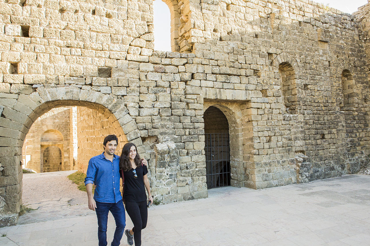
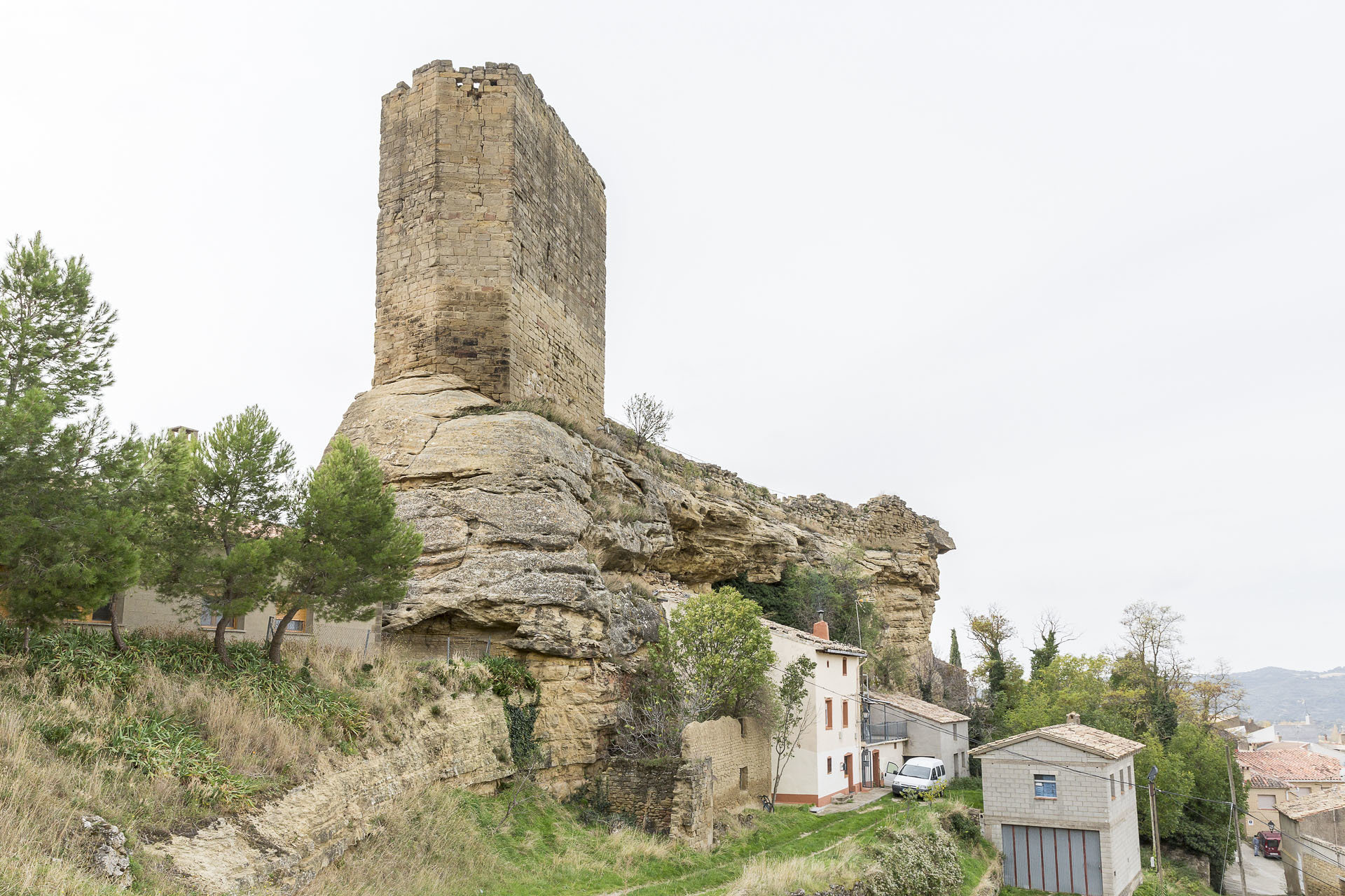
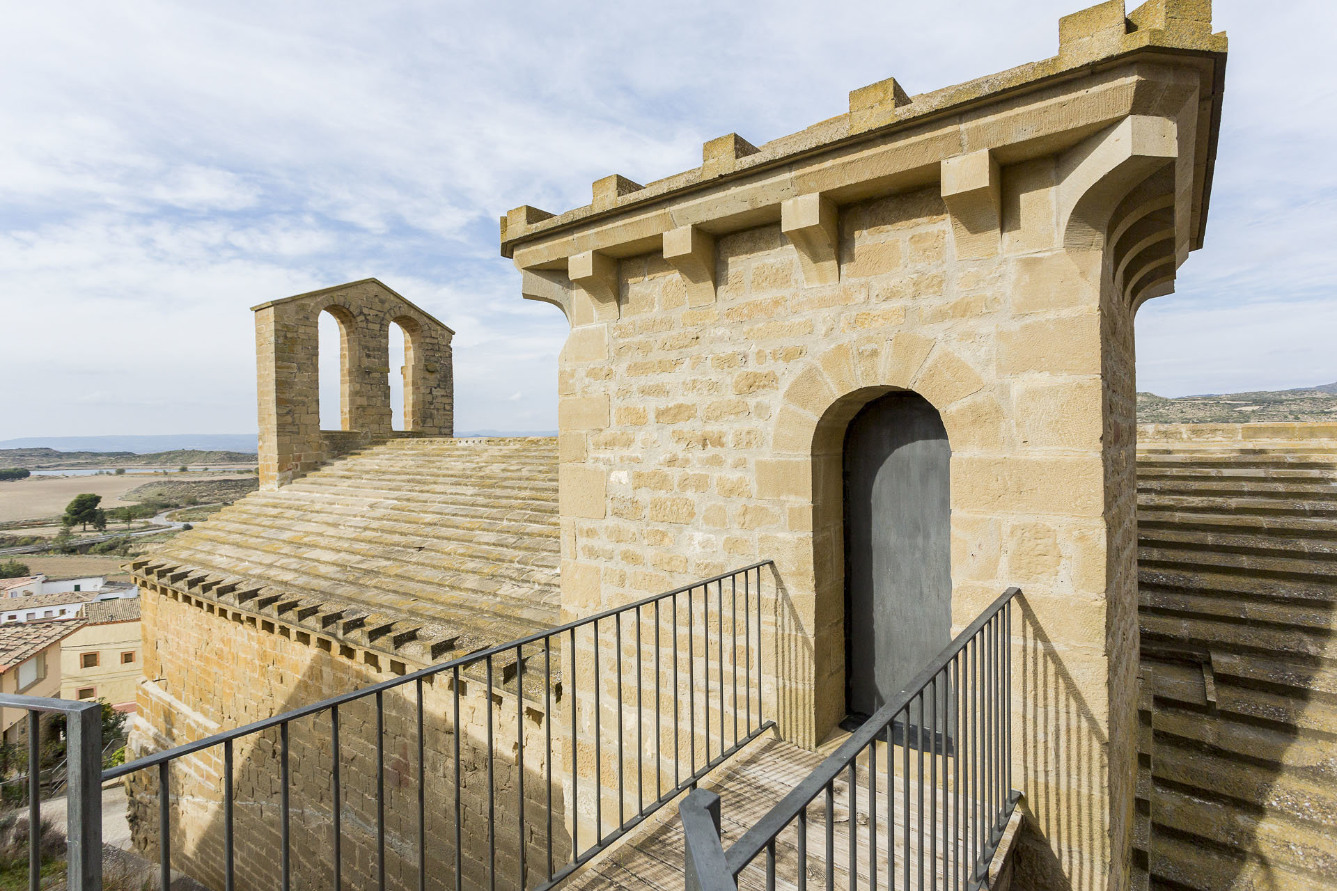
This emblematic fortress, built between the 11th and 12th centuries, is located very close to Ayerbe. Loarre is the grandest and most spectacular castle in Aragon and is considered the best preserved Romanesque castle in Europe. The fortress defended the border line of the kingdom of Aragon to later become a royal palace and then a monastery.

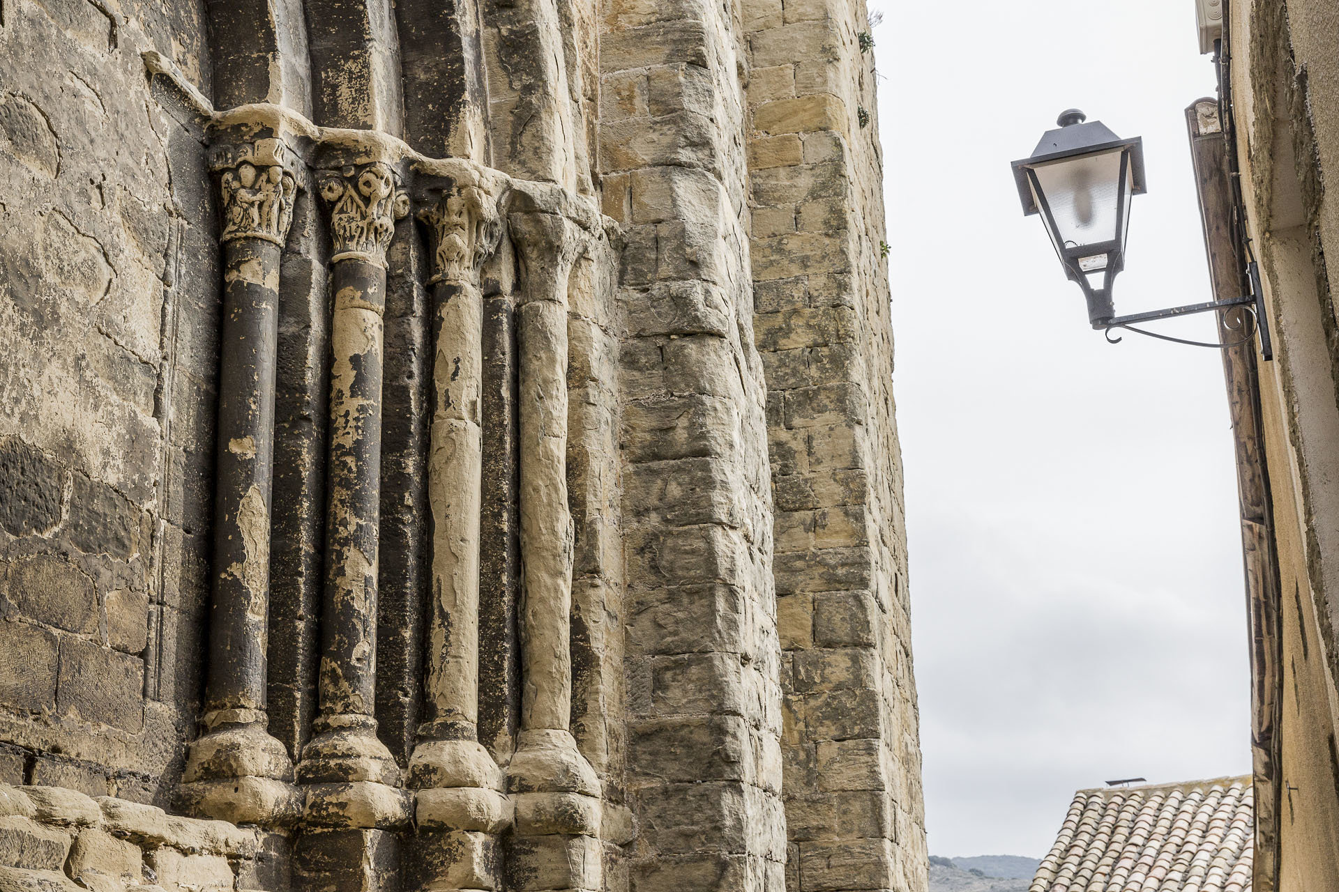
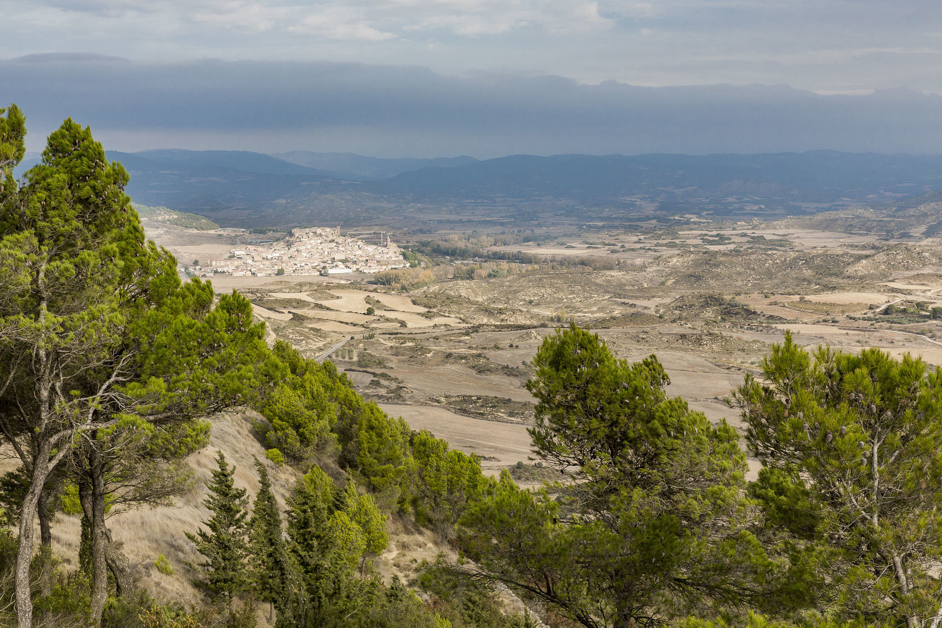
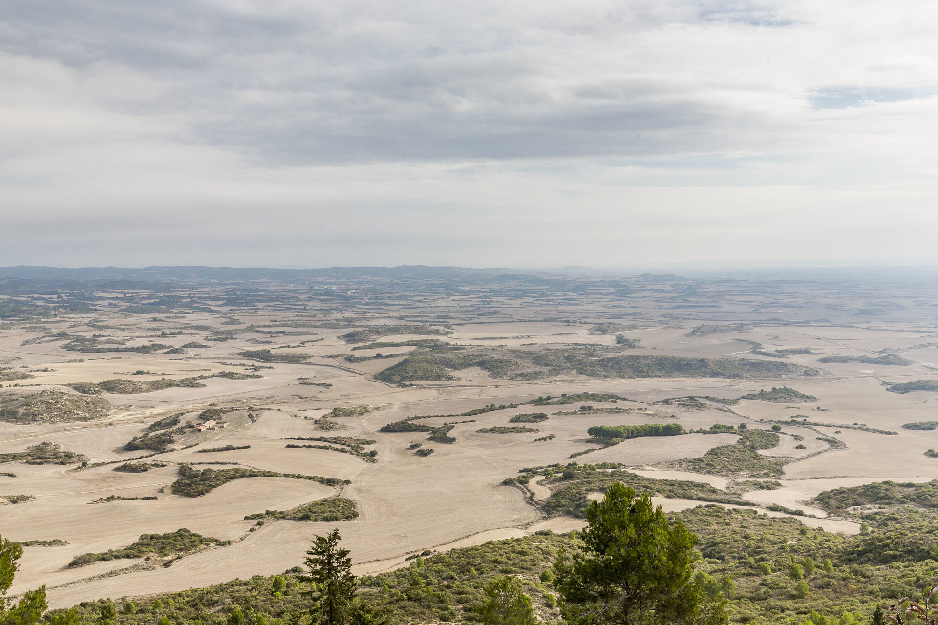
From an architectural point of view, it is one of the most perfect examples of Romanesque art in Spain and Europe. It occupies a spectacular settlement on a high cliff and is surrounded on its south side by a 13th century wall, the rest being protected by the same rock on which the fortress sits. A walk through its interior, more than one thousand metres high, is a true journey back in time to the Middle Ages. A tour of its passageways, towers and dungeons will make us dream of legends of medieval knights, queens looking out from their lookout towers and times of a harsh and austere life in an impressive setting. From the Mirador de la Reina viewpoint there is a fantastic view of the Hoya de Huesca.

Point 1

From Loarre Castle, take the road down to Loarre village then the A1206 south for 12.3km to Ayerbe.

near_me Point 1

From Loarre Castle, take the road down to Loarre village then the A1206 south for 12.3km to Ayerbe.

Ayerbe local_hotellocal_gas_stationrestaurant

The village of Ayerbe is located in the impressive natural and cultural surroundings of the Kingdom of Los Mallos. A historical and monumental town perched on the left bank of the River Gállego at the foot of the Loarre and Luna mountains. Walking through its streets you can see magnificent manor houses and mansions. The tower of San Pedro dating back to the 12th century stands out from its town centre. The two squares of the town are designed around the palace of the Marquises of Ayerbe, in a Gothic-Renaissance style.

The church of San Pedro has an interesting religious museum and an organ from the mid-19th century. Here is where the greatest Spanish scientist and Nobel Prize winner for medicine, Santiago Ramón y Cajal, spent his youth.

In Ayerbe we find history, art and richness of landscapes, but also customs, cultural activities, gastronomy, (you cannot miss out on the famous tortas de Ayerbe) and the special flora and fauna of the Kingdom of Los Mallos. The area is also ideal for adventure sports.

Point 2

Leave Ayerbe by Calle Plaza Aragón, which is the A132. Continue along Avenida Duque de Bivona and turn off at Calle Vial 5 polígono industrial de Ayerbe, which is the A1202. You carry on straight along the A1202, travelling west to Santa Eulalia de Gállego. After 8.5km you cross the Gállego River.

near_me Point 2

Leave Ayerbe by Calle Plaza Aragón, which is the A132. Continue along Avenida Duque de Bivona and turn off at Calle Vial 5 polígono industrial de Ayerbe, which is the A1202. You carry on straight along the A1202, travelling west to Santa Eulalia de Gállego. After 8.5km you cross the Gállego River.

Santa Eulalia de Gállego/Santolaria de Galligo local_hotel

Very close to Ayerbe, Santa Eulalia also forms part of the Kingdom of Los Mallos. Its urban centre sits on a slope of the San Pedro hill. From its elevated streets you have great views of the beautiful landscapes that make up the River Gállego and the majestic “Mallos”.

The town offers beautiful examples of the popular architecture of the area, highlighting admirable constructions built with stone from Armero. The church, with its Romanesque origin, underwent modifications in the 17th century. Once inside, the main altarpiece dating back to the 17th century, a baroque carving of Christ and the image of San Roque at the end of the 16th century are evidently important features. At present, Santa Eulalia de Gállego has the name “Wines of the Land of Ribera del Gállego – Cinco Villas”.

In sports, the town is a very attractive destination, given that it is the point of embarkation and disembarkation for water sports in the rough waters of the River Gállego. In addition, there are other options in the form of excursions, such as hiking, mountain bike routes and climbing in the nearby Mallos de Riglos.

Point 3

Continuing along the same road (A1202) from Santa Eulalia de Gállego for another 18.3km, you reach Fuencalderas.

near_me Point 3

Continuing along the same road (A1202) from Santa Eulalia de Gállego for another 18.3km, you reach Fuencalderas.

Fuencalderas local_hotel

At 6 km from Biel, the small village of Fuencalderas is located on the southern slope of the Protected Landscape of the Santo Domingo mountains. All its natural surroundings are particularly evident, because the different altitude levels of its municipal district are home to a great variety of forests. Its urban centre offers attractive buildings. Its characteristics are its interior design, based on a succession of small squares, and the construction of the houses that still conserve their old appearance in perfect condition.

The current church of Nuestra Señora de la Esperanza presents a mixture of styles due to the time elapsed in its construction, although as a whole it could be placed sometime in the 16th century. 10 km from the urban centre, in what are supposed to be remains of the church of the old town of Liso, we come across the chapel of San Miguel de Liso. In this quiet place, we discover the chapel with the remains of its Romanesque apse, a fountain with the name of this saint and beautiful views.

Point 4

This is reached by continuing along the A1202 in a northwest direction for another 6.7km.

near_me Point 4

This is reached by continuing along the A1202 in a northwest direction for another 6.7km.

Biel local_hotelrestaurant

The town of Biel is located at the foot of the Protected Landscape of the Santo Domingo mountains, on the left bank of the River Arba de Biel. The hamlet stretches around its majestic castle-fortress and the church of San Martín.

The castle consists of an impressive tower from the 11th century, built following the very unusual typology of the French “donjon”. The church, rebuilt in the 16th century, was built on a former Romanesque temple, of which important vestiges remain, such as remains of mural paintings. It was built on a single nave of precious starry vaults.

Very important and very well preserved is its Jewish quarter, the second in importance of the region. This Jewish quarter can be considered an exceptional case, since more than half of Biel’s population was Jewish at the start of the 15th century.

A little lower down we will find suggestive examples of popular architecture: Casa Manolete, Casa Fuertes, Casa Galán… also important is its natural environment, since more than 80% of its municipal area is covered with forests.

Point 5

Here, the A1202 turns southwest after Biel. The road climbs a little, and you follow the road for 14.7km until you reach Luesia.

near_me Point 5

Here, the A1202 turns southwest after Biel. The road climbs a little, and you follow the road for 14.7km until you reach Luesia.

Luesia local_hotellocal_gas_stationrestaurant

This beautiful medieval town is located to the south of the Santo Domingo mountains, with a rich historical and artistic heritage. The urban complex is dominated by the symbols of material and spiritual power in the Middle Ages: the church and the castle. The monumental church of  San Salvador is attached to the remains of the castle and was built in several phases. It has a crypt dating back to the 11th century and the exterior features a spectacular Romanesque doorway and an apse with a defensive appearance. Dominating the town, the castle is one of the main elements that define the appearance of the town. The other religious building of interest is the church of  San Esteban, built directly on rock and with a clearly Romanesque style semi-circular apse. Recently restored, it houses the Museum of Religious Art. In the town centre, the old Jewish quarter and the town hall, with its modest façade of ashlar stone, are worth a visit.

Just a few metres from the Pigalo camping site is the Pozo Pigalo, a large pool of water surrounded by huge folds of rock that form authentic natural stone walls. The Protected Landscape of the Santo Domingo mountains has innumerable scenic, ecological, cultural and historical corners waiting to be discovered.

Point 6

Leave Luesia by the A1202 and shortly you cross the Arba de Luesia river. A further 12.7km and you reach Uncastillo.

near_me Point 6

Leave Luesia by the A1202 and shortly you cross the Arba de Luesia river. A further 12.7km and you reach Uncastillo.

Uncastillo local_hotelrestaurant

With its six Romanesque churches, Uncastillo is considered the best Romanesque ensemble of the 12th century in Spain and one of the best monumental collections from the Middle Ages. The town retains all the medieval flavour bestowed upon it by its magnificent churches of this style, as well as the remains of its walled enclosure, from which the Torre del Homenaje juts out.

Its steep streets, its palatial houses and its old Jewish quarter create a feeling of time standing still. The south façade of the church of Santa María is considered one of the most interesting of the Spanish Romanesque style, showing us a fantastic museum of outdoor sculptures. Inside the church of San Martín is the Interpretation Centre for Religious Art of the pre-Pyrenees. And the austere church of San Juan has notable Romanesque mural paintings.

Palatial residences such as the Renaissance Consistorial house with its monumental façade, the Gothic palace of Martín el Humano or La Lonja, also form part of the extensive list of monuments of the town. Located on La Peña de Ayllón, the castle is the symbol and emblem of the town. In the town there is a remarkable concentration of artisans where we will find products and objects made with much care from yesteryear.

Point 7

Leave Uncastillo by the North by the CV841 and continue along it for 23.5km. Towards the last quarter of the section you hit the A127, where you turn right.

near_me Point 7

Leave Uncastillo by the North by the CV841 and continue along it for 23.5km. Towards the last quarter of the section you hit the A127, where you turn right.

Sos del Rey Católico local_hotellocal_gas_stationrestaurant

Sos is one of the northernmost locations of the Cinco Villas and one of the most monumental, beautiful and representative ensembles of Aragon.

With roots in royal birth and used as a film location, this historical town is a Historical Site that also appears in the list of the most beautiful towns of Spain. Strolling through its streets we can see stone houses with wooden eaves, secluded corners, doorways with shields, Gothic-inspired windows… as well as an abundance of artistic and monumental heritage.

King Ferdinand the Catholic was born in the palace of the Sada. Behind the palace, around thirty houses are set around the charming Plaza de la Sartén, forming the heart of the old Jewish quarter. Plaza de la Villa is occupied by two monumental buildings: the Town Hall and the College of Isidoro Gil de Jaz. The third side is occupied by some evocative stone porches, where the market was located (with the hole where the scales were hung and the measuring rod inscribed on the wall). For its Romanesque heritage, the churches of San Martín de Tours and San Esteban are worthwhile visiting. At the top is the medieval fish market and the isolated Castle Tower, with a spectacular view.

Point 8

You leave Sos del Rey Católico by the A127 going south until you reach a roundabout, where you take the first exit, the CV868 for 16km to Sofuentes.

near_me Point 8

You leave Sos del Rey Católico by the A127 going south until you reach a roundabout, where you take the first exit, the CV868 for 16km to Sofuentes.

Sofuentes local_hotelrestaurant

After leaving Sos, and after crossing the small nucleus of Mamillas, we reach Sofuentes. The abundance of Romanesque-imperial remains in this region leads us to believe that there was a prolonged presence of an entire family clan of landowners with an economic potential that allowed them to build, not only imposing mausoleums, but modern and complex thermal facilities, such as the Bañales de Uncastillo.

It is not strange that when we walk through the streets of this small town located near the old Vía Augusta it is surprising to see how residents have altars in their homes, inscriptions on the doors, Corinthian capitals supporting balconies, milestones in the gardens, blocks with sepulchral captions… constituting an authentic open-air museum. Among its buildings there is an interesting medieval tower with pointed arches and loopholes. The Convent of Los Escolapios is a set of dependencies of the 17th century with a small baroque church. The church of San José de Calasanz preserves a Gothic carving of the Virgin with Child and a baroque Christ dating back to the 18th century.

    Point 9

    From Sofuentes, you take the CV868 going southeast for 7.8km to Castiliscar.

    near_me Point 9

    From Sofuentes, you take the CV868 going southeast for 7.8km to Castiliscar.

    Castiliscar restaurant

    Castiliscar occupies a rocky plateau around which the houses are grouped in a very similar way to Uncastillo. The municipality treasures the history and heritage of its streets.

    This was the Romanesque road that connected Caesar Augusta and Pompaelo. The town retains the medieval layout and the old farmhouse within which you can admire several palaces. The castle was erected on a rocky plateau for the defence of the territory. From it remains a tower reused as a bell tower of the present chapel of Santo Cristo. The Romanesque parish church was built next to the castle in the 12th century. In its interior is where we can find the most artistic element of the town: a magnificent paleo-Christian sarcophagus that acts as the main altar. It is a piece from the 14th century, of extraordinary artistic quality and in excellent condition, made in Carrara marble.

    Also interesting is the Museum of the Order of San Juan that offers us the chance to learn about the history of the municipality and the different relationships with nearby towns where this Medieval Order possessed property and rights.

    In the surroundings the Estanca reservoir is a wetland that has been established as a recreational area.

    Point 10

    Head south on the A127 for 12.1km to Sádaba.

    near_me Point 10

    Head south on the A127 for 12.1km to Sádaba.

    Sádaba local_hotellocal_gas_stationrestaurant

    Sádaba is a town of undoubted medieval flavour that sits on the plains of Cinco Villas. It is impossible to confuse the profile of the town, thanks to its magnificent castle, one of the most monumental and representative of its period in Aragon. Dating back to the 13th century, this monument, which is both modest and at the same time majestic, stands on a mound overlooking the village.

    A walk through the old town will allow us to discover the remains of its medieval wall, the interweaving of its streets, the sobriety of its buildings and the beauty of some noble houses. The other main monument of the town is the elegant church of Santa María, one of the most beautiful examples of Gothic architecture in Aragon. To the outside, a beautiful tower of a modest and elegant Gothic style completes the collection.

    In its municipal area, Sádaba conserves two important remains from the Romanesque period: the façade of the mausoleum of Los Atilios, from the 2nd century AD and the remains of the mausoleum of the “Synagogue” from the 4th century AD. In the surroundings, the church of Puylampa presents a beautiful Romanesque façade.

    Point 11

    Continue along the A127 southeast on a stretch that is practically a straight line for 21.5km.

    near_me Point 11

    Continue along the A127 southeast on a stretch that is practically a straight line for 21.5km.

    Ejea de los Caballeros local_hotellocal_gas_stationrestaurant

    Ejea is one of the most populated municipalities of Aragon and the capital of the Cinco Villas region.

    Upon arrival we come across the church-fortress of San Salvador with crenelated tower. Inside, the main altarpiece shines with a unique repertoire of images on daily life in the 15th century. Following the three main streets of the urban centre we will pass by houses in an Aragonese Renaissance style. From Plaza de España we ascend to the church of Santa María. It has Romanesque elements such as the apse and the south façade, while the bell tower was built later. This area was also the Jewish quarter of the city, considered the fifth in importance of all Aragon. The church of Nuestra Señora de la Oliva, of popular baroque style, closes off the other end of the historic quarter.

    When leaving Ejea, on the road to Rivas, you can find the Museum of Beekeeping. And a natural enclave to visit is the Moncayuelo. This lagoon offers the possibility of taking long walks through almost 40 hectares of open space that surrounds it.

    Point 12

    Take the A125 heading east for 16.9km. This is the so-called Erla road.

    near_me Point 12

    Take the A125 heading east for 16.9km. This is the so-called Erla road.

    Erla local_gas_stationrestaurant

    The town of Erla is found some 15 km from Ejea, stood on a hill. The town extends at the foot of Mount Corona, on top of which are the remains of an ancient castle. A few metres below the level of the castle is the restored, but Romanesque in origin, chapel of La Virgen de la Corona. The urban centre is accessed by the arch under the Gothic tower of the Señorío de los López de Gurrea. The tower, dating from the 15th century, is one of the most notable in the province. It is attached to the parish of Santa María and is a local prototype of the buildings that combined residence and defence purposes. The church of Santa María and the attached tower is a combination of protogothic style dating from the mid-13th century. Inside, the altarpieces of the Virgen de la Corona and San Juan Bautista are important features.

    Point 13

    Leave Erla by Avenida Goya then take the A125 until you reach a roundabout. Take the third exit towards Luna, which is the A1103. Continue for about 1km and turn right to take the road leading to this destination.

    near_me Point 13

    Leave Erla by Avenida Goya then take the A125 until you reach a roundabout. Take the third exit towards Luna, which is the A1103. Continue for about 1km and turn right to take the road leading to this destination.

    Nuestra Señora de Monlora restaurant

    Located 5 km from Luna, the santuario of La Virgen de Monlora is located on a spectacular high plateau that stands out among the plains of Cinco Villas. It is the most famous and emblematic place in Luna and the altar of its patron (famous for making the water of the monastery’s reservoirs miraculous).The building was built in 1500, remodelled and later modified in 1762. Since its construction, it has been inhabited by Franciscans until 1837. In the church of the Santuario (18th century) its highlights are the main altarpiece, 4 canvases by José Luzán (Goya’s teacher) and a valuable wooden sculpture of Ecce Homo. Worthy of mention is the flamboyant Gothic portico of the cloister. From the top you can see the White Pyrenees on the horizon, as well as the pre-Pyrenean mountain ranges, the Mallos de Riglos, the Moncayo, the Hoya de Huesca  and the whole region of Cinco Villas to Navarra.

    Point 14

    Return by the road you came on and go south down the A1103 until you reach a roundabout. Take the third exit and travel along the A125 to Valpalmas. The total distance is 12.3km.

    near_me Point 14

    Return by the road you came on and go south down the A1103 until you reach a roundabout. Take the third exit and travel along the A125 to Valpalmas. The total distance is 12.3km.

    Valpalmas restaurant

    Valpalmas is located in a wild valley where the medieval route from Luna to Huesca ran.

    The town has large manor houses in the Aragonese style and the house where Nobel Prize winner for medicine, Santiago Ramón y Cajal, lived as a child. This cultural centre brings together and explains many facets of the great researcher with graphic and written documents. Strolling through its streets we can also see the church of San Hipólito with Romanesque elements and construction in stone masonry.

    Near this town you can visit a curious landscape, known as “Los Aguarales de Valpalmas”. Los Aguarales are the result of a curious landscape of whimsical shapes that are produced by rainwater on clay that, along with the wind and passing of time, have been responsible for modelling these beautiful formations, also known as “chimeneas de hadas” or “fairy chimneys”. A beautiful sculptural museum where you have to let your imagination run wild to discover every corner of this mud city which, due to its expanse and spectacular nature, is unparalleled in the rest of Spain.

    End of route

    From Valpalmas, take the CV613 leaving by Calle Nueva and continue for 6.8km until you reach the destination. From here, you can join the Aragon Kings Route in the section between Puendeluna and Nuestra Señora del Salz.

    near_me End of route

    From Valpalmas, take the CV613 leaving by Calle Nueva and continue for 6.8km until you reach the destination. From here, you can join the Aragon Kings Route in the section between Puendeluna and Nuestra Señora del Salz.

    Piedratajada

    This small town takes its name from the rocky enclave in which it is located. Its town centre is formed by a set of old stone manor houses that make up a good part of the buildings in the town. Among the houses, the parish church of San Sebastián stands out from the 14th century. It is a temple in a Gothic-Levantine style, with a single nave and head with a straight section and another polygonal, which is accessed by a cover in a semi-circular arch. In its interior altarpieces of great interest are kept, such as that of San Sebastian from the 16th century in a Mannerist style, or those of the Virgin.

    The town preserves two peirons: the Pilar de la Cruz, in the place of the same name, and that of San Isidro, to the outskirts of the town. Also on the outskirts of the town there is an old well of ice that is conserved. Near Piedratajada you can still see remains of ancient copper mines and archaeological sites, such as that of San Melorge.